Met Office Forecasts Temperature Rise and Potential 'Super El Niño' Event
The Met Office has issued its latest weather forecast, indicating that temperatures across the United Kingdom are set to increase as summer approaches. This announcement comes alongside a detailed analysis of the potential return of a strong El Niño climate pattern, which could have far-reaching effects on global weather systems.
Recent Temperature Trends and Upcoming Forecast
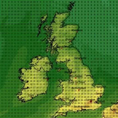
Last week witnessed some of the warmest temperatures recorded this year, with Kew Gardens in London reaching a peak of 26.6°C. Although the weekend brought cooler conditions with cloud cover and rain replacing the sunny spells, the Met Office predicts a significant warming trend in the coming days. Temperatures are expected to climb to approximately 16°C in London on Thursday, potentially rising to 18°C in London, Birmingham, and Norwich by Friday.
This upward trend in temperatures aligns with the seasonal transition toward summer, but meteorologists are also closely monitoring broader climate patterns that could influence weather conditions in the months ahead.

Understanding the El Niño Phenomenon
The Met Office has provided its verdict on the possible emergence of a strong El Niño event. El Niño is a natural climate pattern characterized by the warming of sea surface temperatures in the central-east equatorial Pacific Ocean. This phenomenon typically occurs every three to seven years and forms part of the El Niño–Southern Oscillation cycle, which alternates between warm (El Niño) and cool (La Niña) phases.
During an El Niño event, trade winds weaken, allowing warm water to shift eastward. This disruption often leads to significant changes in global weather patterns, including increased global temperatures, droughts in certain regions, and heavy rainfall in others. The Met Office emphasizes that each El Niño event is unique, with stronger events generally producing more pronounced and widespread effects.
Potential for a 'Super El Niño'
Current projections suggest that the forthcoming El Niño could be particularly strong, with some discussions referring to it as a "super" El Niño. While the Met Office does not officially recognize this term, there is growing confidence among scientists that this event could rank at the upper end of the historical strength range.
Grahame Madge, Senior Press Officer and Climate Science Communicator at the Met Office, commented: "A 'super' El Niño is not a term we subscribe to, but it does underpin the fact that this is likely to be a significant event. Scientists are telling us that this could be the strongest El Niño event so far this century, comparable to the notable El Niño event in 1998."
The exact timing and regional impacts of this potential El Niño remain uncertain, but the Met Office notes that it could influence weather patterns globally, including in the UK.
Short-Term and Long-Range Weather Outlook for the UK
In the immediate future, Britons can expect predominantly dry and sunny weather. The long-range forecast for April 20 to 29 indicates that high pressure to the north or northeast of the UK will bring plenty of dry conditions and sunny spells initially. However, low pressure in the Atlantic may attempt to push weather fronts toward the UK from the southwest, though these fronts are likely to remain slow-moving.
Some eastern coastal areas might experience cooler temperatures due to low cloud cover and onshore breezes, while western regions are expected to feel quite warm, especially in sunnier locations. From the weekend of April 20 onward, there are signs that more unsettled weather could return, potentially bringing rain or showers to various parts of the country.
As temperatures rise and the possibility of a significant El Niño event looms, the Met Office continues to monitor developments closely, providing updates to help the public prepare for changing weather conditions.