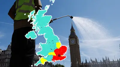
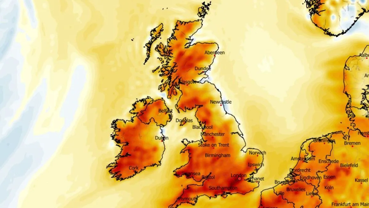
UK Weather Maps Predict 23C Heat Surge Across 28 Counties in Late April
UK Weather Maps Show 23C Heat Surge in 28 Counties

UK Weather Maps Forecast 23C Heat Surge as 28 Counties Brace for Scorching Temperatures

According to the latest weather forecasting maps, the United Kingdom is set to experience a significant heat surge later this month, with temperatures potentially soaring to 23C in some regions. The data suggests that as many as 28 counties could see the mercury rise to 20C or above, marking a notable departure from typical April weather patterns.

ECMWF Model Highlights Widespread Warmth

The ECMWF weather model reveals that Britons should prepare for balmy conditions, particularly towards the end of April. Peak temperatures are expected in the south-east of England and along the south coast on April 29. However, the warmth will not be confined to these areas; East Anglia, the Midlands, and parts of Wales are also forecast to enjoy milder weather.

Further north, temperatures are predicted to remain relatively mild, with highs of 18C anticipated in Northern Ireland and southern Scotland, and 16C in the Scottish Highlands. This widespread warmth indicates a substantial shift from the seasonal average, as temperature anomaly maps show the mercury rising well above normal levels.

Wide Pickt banner — collaborative shopping lists app for Telegram, phone mockup with grocery list

List of Counties Facing 20C or Above

The following 28 counties are identified as likely to experience temperatures of 20C or above on April 29, based on the latest mapping data:

  • Pembrokeshire
  • Cardiganshire
  • Carmarthenshire
  • Glamorgan
  • Brecknockshire
  • Staffordshire
  • Warwickshire
  • Worcestershire
  • Gloucestershire
  • Cornwall
  • Devon
  • Somerset
  • Dorset
  • Wiltshire
  • Berkshire
  • Oxfordshire
  • Hampshire
  • Sussex
  • Surrey
  • Kent
  • Middlesex
  • Essex
  • Hertfordshire
  • Buckinghamshire
  • Bedfordshire
  • Cambridgeshire
  • Norfolk
  • Suffolk

Met Office Forecast: High Pressure and Unseasonal Snow

The Met Office has indicated that high pressure could dominate the weather pattern before the month's end, bringing plenty of dry conditions and sunny spells initially. However, their forecast for April 21 to 30 also warns of potential unseasonal disruptions.

According to the Met Office, scattered showers may occur in central and eastern areas, with parts of the east coast experiencing chilly conditions due to low cloud and an onshore breeze. In contrast, western regions are expected to feel quite warm, especially in sunnier spots.

By the weekend, unsettled weather is predicted to return, though confidence in the specifics remains low. One possible scenario involves a northerly wind bringing wintry showers to northern and eastern coasts, with some snow over Scottish mountains. If this occurs, it is likely to be short-lived, lasting only a few days before high pressure attempts to reassert itself towards the end of April.

This mixed forecast underscores the variability of UK weather, with the heat surge offering a brief respite from cooler temperatures, yet the threat of snow reminding residents of April's unpredictable nature. As always, it is advisable to stay updated with the latest forecasts from reliable sources like the Met Office.

Pickt after-article banner — collaborative shopping lists app with family illustration