Yellow warnings for heavy rain remain in place across parts of Northern Ireland, Scotland, south-west England and Wales as Storm Ingrid continues to cause disruption, the Met Office said on Saturday. The storm, named by the Portuguese national weather service IPMA, has brought powerful waves and high winds to the south-west.
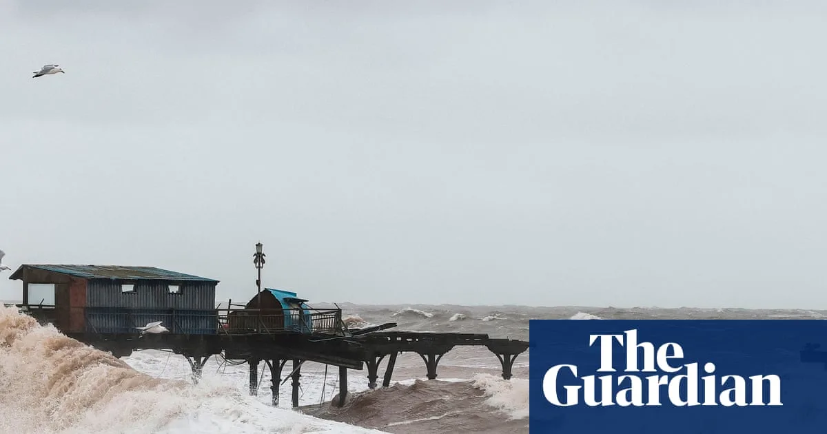
In the Devon coastal town of Teignmouth, part of the Victorian pier collapsed under the force of the waves. The town’s mayor, Cate Williams, described the damage as “really sad” and noted that the pier is a focal point of the community. The storm also damaged benches, flower beds and paving stones near the seafront.
The Environment Agency has issued 13 flood warnings across south-west England, meaning flooding is expected, along with 135 flood alerts indicating possible flooding in many areas. Around 20-40mm of rainfall is forecast across most of the south-west, with up to 50mm possible in some exposed locations, heightening flood risk.

National Rail reported major disruption to railway services in south-west England, with cancellations and delays expected to last all day on Saturday. Yellow warnings for heavy rain in Northern Ireland and Scotland will remain in place until 9am on Sunday.