
The Met Office has urged residents in 23 regions across south-west England and Wales to prepare emergency flood kits as Storm Ingrid brings heavy rain and winds of up to 60mph. A yellow weather warning is in place from 2am on Friday until 9am on Saturday, with up to 40mm of rain expected on already saturated ground, increasing the risk of flooding.
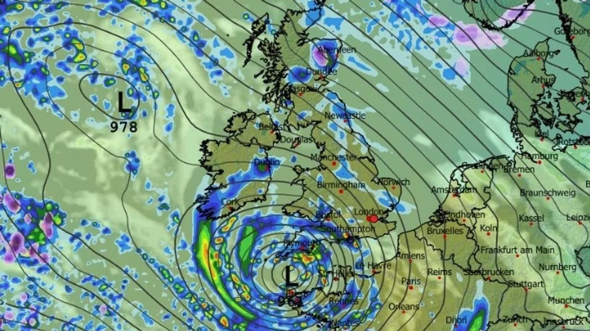
Storm Ingrid, named by the Portuguese weather service, is moving northwards and will affect areas including Devon, Cornwall, and parts of Wales. The Met Office warned of 'periods of heavy rain and strong winds' likely to cause flooding and travel disruption. People are advised to gather torches, batteries, and mobile phone power packs in case of power cuts.
The warning follows an amber 'danger to life' alert in Scotland earlier on Thursday. Eastern Scotland and Northern Ireland have already seen the worst of the rain, with conditions expected to persist over the coming days. The Met Office chief forecaster Neil Armstrong said the slow-moving system would bring more than 20mm of rain, with gusts of 45-50mph inland and up to 60mph near coasts.

Residents are urged to check if their property is at risk of flooding and to prepare a flood plan and emergency kit. The warning covers 23 areas, with the rain and wind expected to ease by Saturday morning.


