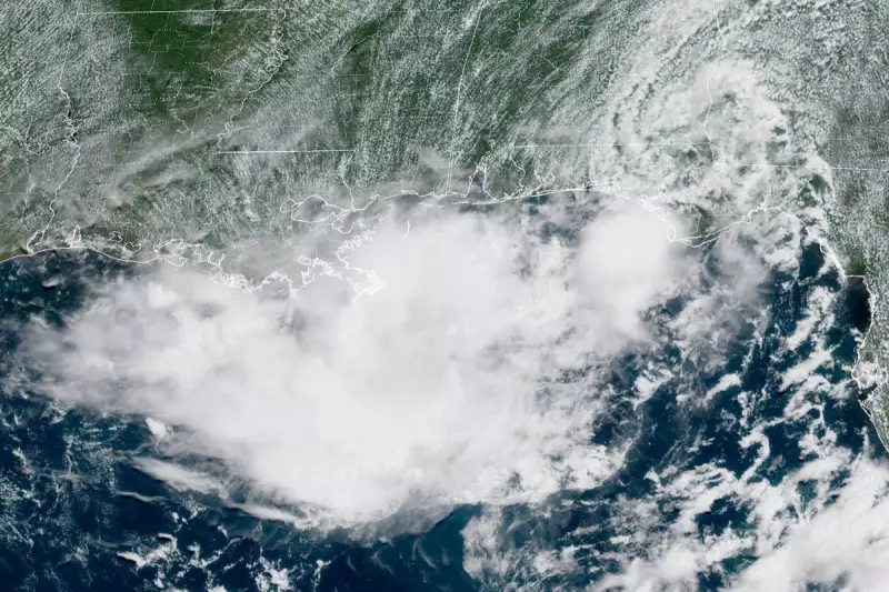
A developing tropical disturbance in the Gulf of Mexico is poised to escalate into a significant storm, putting coastal regions of Louisiana, Mississippi, and Alabama on high alert. The National Hurricane Center has issued warnings as the system is expected to bring torrential rainfall and possible flooding to the area.
Impending Storm Threatens Gulf States
Meteorologists are closely monitoring the disturbance, which is forecast to intensify over the next 48 hours. The storm's projected path suggests it will make landfall along the central Gulf Coast, with Louisiana likely bearing the brunt of the impact.
Residents Urged to Prepare
Local authorities have advised residents to take immediate precautions:

- Secure outdoor items that could become projectiles in strong winds
- Stock up on essential supplies including food, water, and medications
- Prepare evacuation plans in case of flooding
- Stay informed through official weather channels
Potential Impacts
The storm system is expected to produce:
- Rainfall totals of 6-12 inches, with isolated areas receiving up to 15 inches
- Coastal flooding due to storm surge
- Strong winds capable of downing trees and power lines
- Possible tornadoes in outer rain bands
Emergency services across the region are on standby, with flood response teams particularly vigilant in low-lying areas. Power companies have mobilized repair crews in anticipation of widespread outages.
Historical Context
This developing storm comes as the Gulf Coast enters the peak of hurricane season, which runs from August through October. The region has experienced several devastating storms in recent years, including Hurricane Ida in 2021 which caused catastrophic damage in Louisiana.
Weather officials emphasize that even if the system doesn't reach hurricane strength, tropical storms can still produce dangerous conditions, particularly through freshwater flooding.