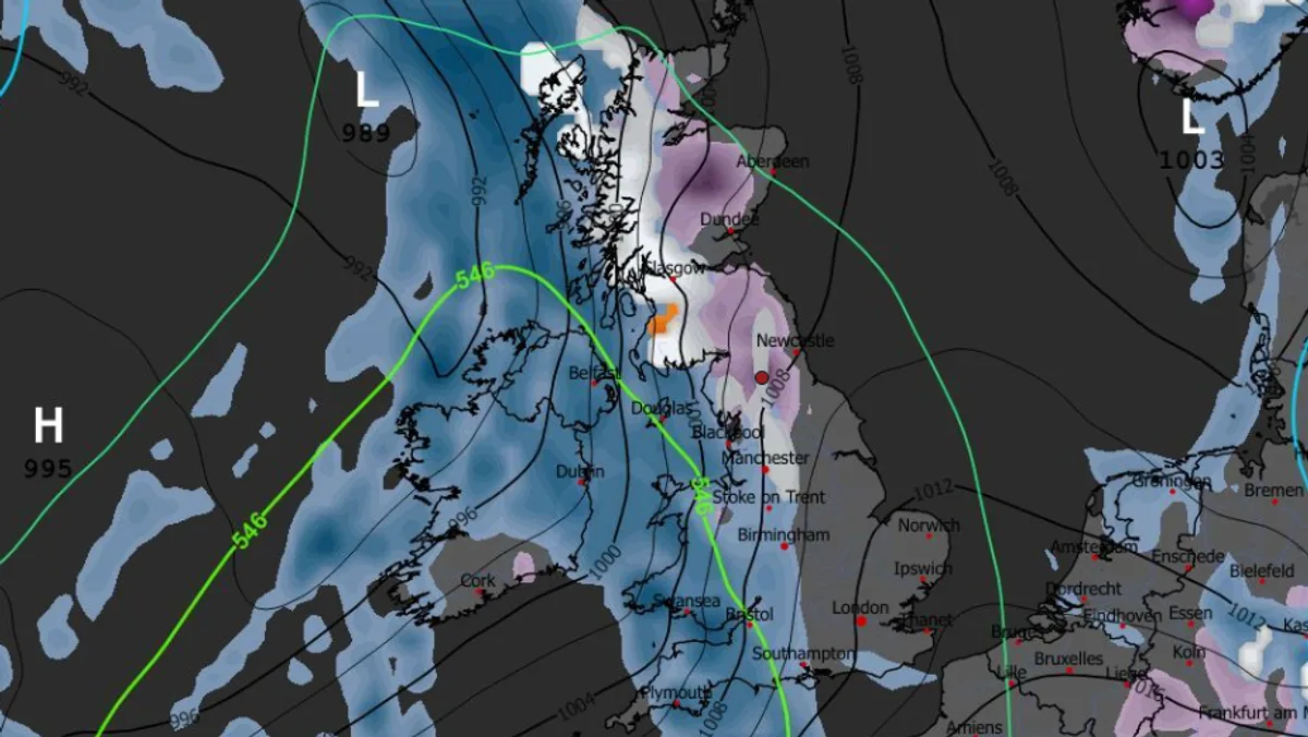
Britain is bracing for a significant cold snap as advanced weather models predict a wintry blast sweeping across the country this weekend. An Arctic weather front is expected to deliver snow to numerous towns and cities, with some northern areas potentially seeing accumulations of up to 8 centimetres.
Weekend Snowfall Timeline
The freezing conditions are forecast to begin in the early hours of Saturday morning. According to the GFS weather model, the system will first make landfall over North Wales and northern England around 9am.
The initial precipitation is expected to fall as heavy rain in the north-east and north-west of England. However, higher ground in the Pennines, the Lake District, and Snowdonia is likely to see this fall as snow.
By 3pm on Saturday, the weather maps indicate that the snow will become more concentrated across northern England and southern Scotland. Data suggests that up to 4cm of snow could settle across large parts of northern England, with the Pennines identified as a particular area at risk.
Towns and Cities in the Firing Line
Snow coverage maps have identified eighteen specific locations that could be affected by the wintry showers from Saturday through to Monday. The list includes a mix of major urban centres and towns across the nation.
The areas at potential risk are:
- Bangor
- Stoke
- Manchester
- Leeds
- Huddersfield
- Bradford
- York
- Harrogate
- Middlesbrough
- Durham
- Newcastle
- Carlisle
- Penrith
- Kendal
- Glasgow
- Edinburgh
- Dundee
- Inverness
Fortunately, for most of these towns and cities, snow accumulations are not expected to exceed 1cm. The heavier snowfall is predicted for more elevated regions in England, which could see around 4cm, and northern Scotland, where a significant 8cm is possible.
Further Wintry Weather and Official Forecasts
The unsettled conditions look set to continue into the start of the new week. Weather maps for next Monday morning suggest another band of snow could sweep across Scotland, northern England, and parts of central England.
The Met Office has confirmed that conditions will turn colder by the end of this week, with further snow possible in December. Their forecast for the period from November 30 to December 9 describes "changeable and unsettled conditions" across the UK, dominated by low-pressure systems.
They state: "Showers or longer spells of rain for much of the UK... Snow will probably be confined to high ground in the north." The Met Office also warns of potential periods of strong wind, especially around coasts.
In contrast, BBC Weather predicts a temporary increase in temperatures mid-week, suggesting any wintry precipitation will initially be confined to the Highlands. However, they note that "chillier air should follow, with temperatures closer to seasonal values by Sunday," aligning with the potential for weekend snow.
Residents in the affected regions are advised to stay updated with the latest forecasts and be prepared for potential travel disruption as the Arctic blast takes hold.