
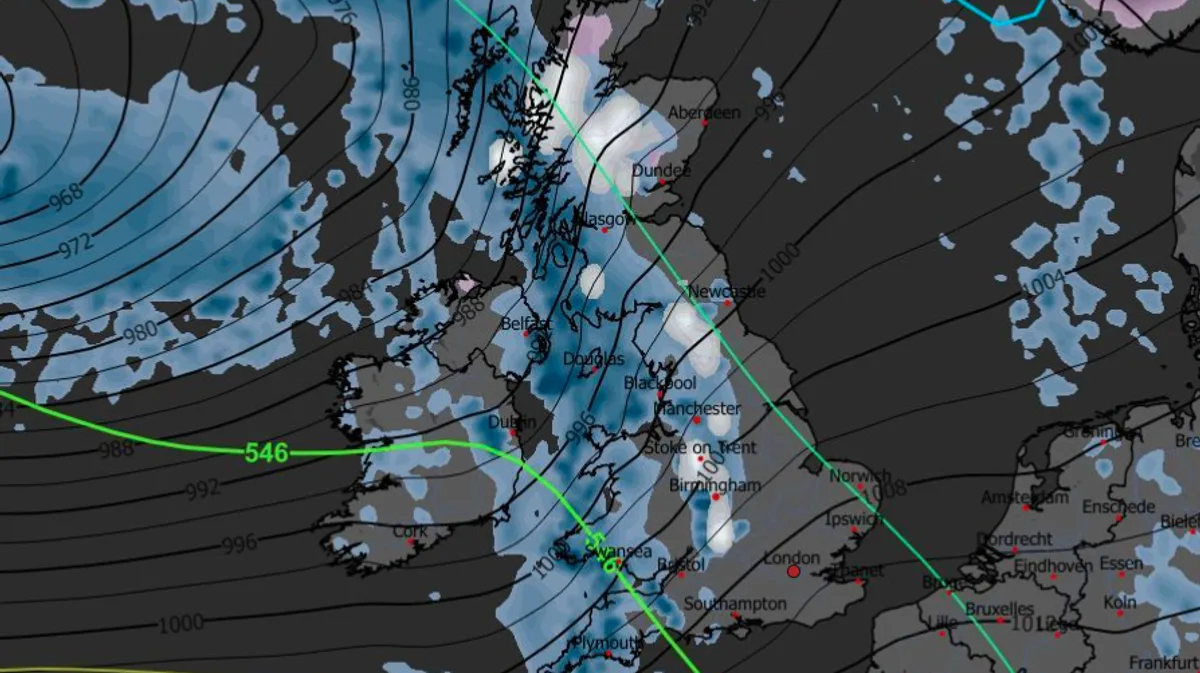
Weather maps indicate that up to seven inches of snow could fall across parts of the UK on Saturday, December 6, as an Arctic weather system moves in from the northwest. Forecasters at Metdesk predict the snow will be widespread, with the heaviest accumulations expected in the Scottish Highlands, Cumbria, and Staffordshire.
The cold snap follows a brief respite from last week's freezing temperatures, which brought snow as far south as London. Temperatures have since risen, with a high of 11.7°C recorded near Preston, Lancashire, on Monday. However, the mercury is expected to plunge again in early December, leading to the next period of snowfall.
According to weather charts, snow may also reach the Cotswolds and other parts of southern England, with light dustings likely across most of Wales and northwest England later on December 6. The snowy conditions could persist for a couple of days thereafter.

Despite the forecast, experts suggest this pattern is unlikely to lead to a white Christmas. Temperatures are expected to rise again in the week following the Arctic storm. In the days leading up to December 6, conditions will be cold and wet for most of the UK, with heavy rain expected, particularly in western areas.
Nick Finnis, a forecaster at Netweather, warned of potential flooding, stating that rainfall totals could exceed 100mm in the west. He also noted that spring tides at the end of the following week could bring a risk of coastal flooding if accompanied by strong winds. The BBC Weather forecast for December 1-7 indicates that a weakening front could bring some rain further south and east, but the overall pattern remains uncertain.


