
The Met Office has issued a stark warning for the islands of Cape Verde, forecasting an unusually early and intense start to the 2025 hurricane season. The archipelago, a crucial formation point for major Atlantic storms, could face significant weather disruptions beginning as early as June.
Senior meteorologists are predicting a 'perfect storm' of climatic conditions, including exceptionally warm sea surface temperatures in the tropical Atlantic. This oceanic heat acts as rocket fuel for developing weather systems, potentially turbocharging tropical depressions into powerful hurricanes.
Why Cape Verde is the Atlantic's Hurricane Nursery
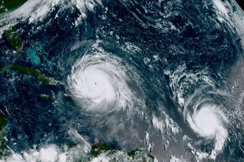
The islands' geographical position makes them a critical watch zone for meteorologists worldwide. Long-track Cape Verde hurricanes are notorious for their potential to intensify into catastrophic events as they traverse the Atlantic basin, often threatening the Caribbean and the eastern seaboard of the United States.

This early forecast is not just a statistical prediction; it carries profound implications for disaster preparedness and regional safety. Local authorities are being urged to review evacuation plans and communication strategies well ahead of the traditional peak season.
What This Means for the Wider Atlantic
An hyperactive season originating from Cape Verde doesn't just concern the islands themselves. It signals a summer and autumn of heightened risk for the entire Atlantic basin. Shipping lanes, oil rigs, and coastal communities thousands of miles away need to pay close attention to these developing patterns.
The Met Office continues to monitor key indicators, including the state of the El Niño-Southern Oscillation (ENSO), which plays a pivotal role in either suppressing or enabling hurricane development. The final seasonal outlook will be released in the spring, but the current data points towards a year of exceptional activity.


