
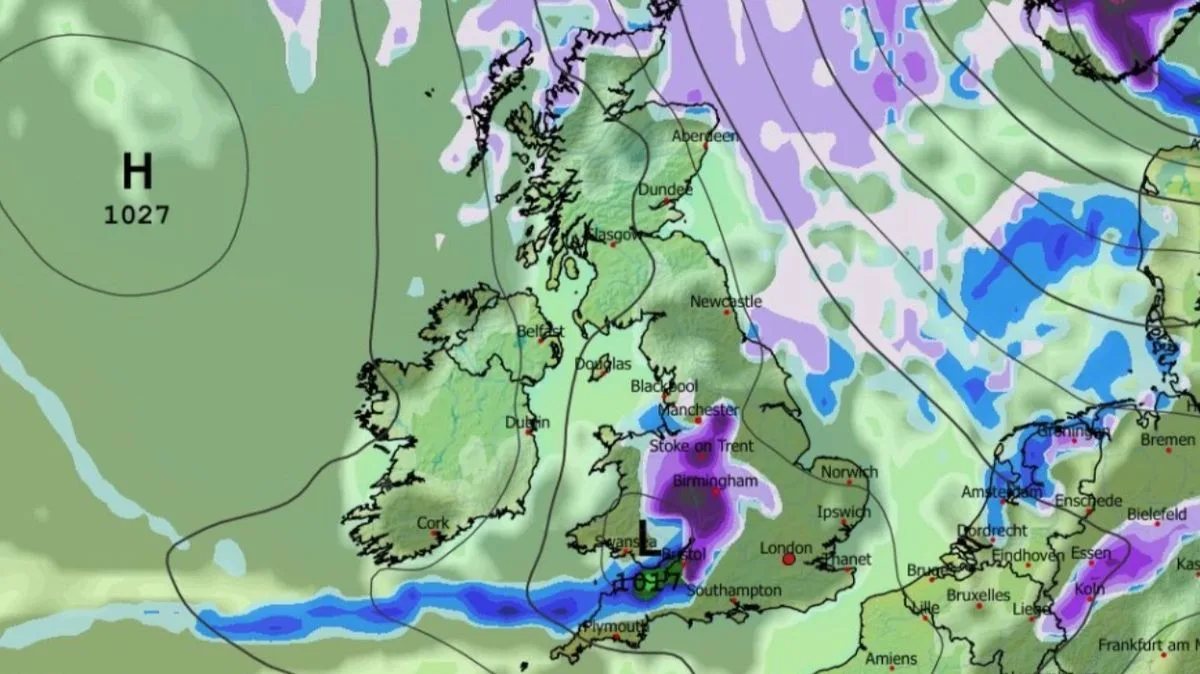
New weather maps indicate that up to 38 cities across the UK could see snow over a three-day period starting April 28, with flurries potentially reaching as far south as London. The GFS weather model shows snow beginning in northern Scotland at midday on April 28 before drifting southward.
By April 29, snow is expected across northern England, Yorkshire, Lincolnshire, Scotland, and Northern Ireland, with rain in the far south-east. A second band of snow from the west is forecast to bring heavier falls to Manchester, Birmingham, and Bristol by early April 30.
The Met Office has warned of a brief cold spell with “wintry showers” in the north and east, and widespread overnight frost. However, it expects milder conditions to return quickly. The forecast for April 22 to May 1 notes high pressure to the north or northwest, with dry weather overall but potential for cold air to sweep south.
Maps suggest London could see light snow around 9am on April 30, though significantly weaker than in western areas. The Met Office advises that any cold spell is likely short-lived.




