
A powerful and frigid Antarctic air mass has slammed into southeastern Australia, delivering a dramatic farewell to winter with a potent mix of heavy snowfalls and destructive winds.
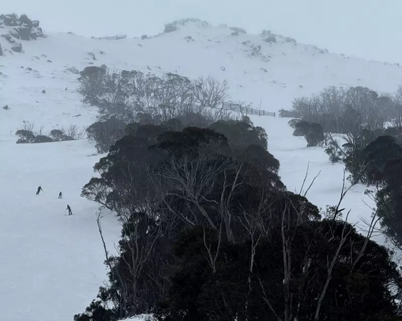
The intense cold front, which swept across Victoria, Tasmania, and parts of New South Wales, transformed alpine landscapes into a winter wonderland overnight. Resorts like Perisher and Thredbo reported significant accumulations, with falls reaching down to elevations as low as 700 metres in some areas.
Travel Chaos and Safety Warnings
The abrupt change in conditions caused immediate disruptions. Authorities were forced to issue warnings for motorists in affected regions, urging extreme caution on icy roads. Strong wind gusts, recorded in excess of 90km/h in coastal areas, also raised concerns about potential damage to property and localised power outages.

"This is a classic late-winter blast," a senior forecaster with the Bureau of Meteorology noted. "The system is characterised by its very cold air and vigorous winds, making conditions particularly challenging, especially for high-country travel."
A Brief Return to Winter's Grasp
Despite the official end of winter being merely days away, the mercury plummeted sharply. Major cities, including Melbourne, felt the bite as temperatures dropped well below the seasonal average. The system serves as a stark reminder that the transition into spring can often be a volatile and unpredictable process.
While the severe weather warnings are beginning to ease as the front moves off the east coast, a cold and unstable air flow is expected to linger for the next several days. This will likely lead to further isolated snow showers across the alpine peaks before a gradual warming trend takes hold later in the week.


