
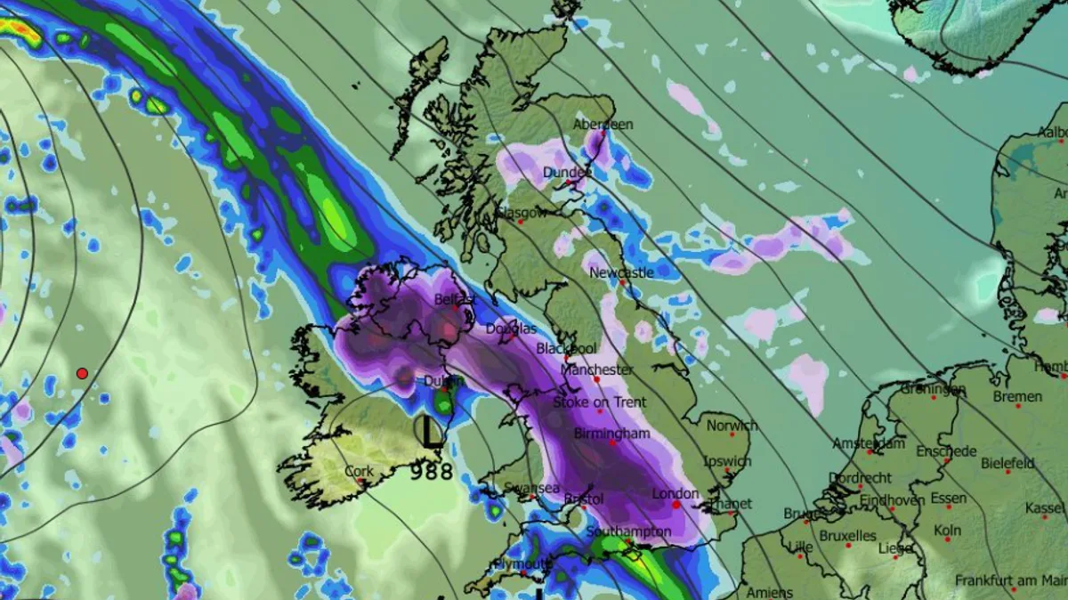
New weather maps show a 24-hour blizzard could bring up to 20 inches of snow to parts of the UK, with several cities potentially affected. The ECMWF model indicates that snow will begin to fall in Northern Ireland and Wales from the early hours of January 27, before spreading to the Midlands, southern England, and Scotland by midday.
The heaviest accumulations are expected in northern Scotland and Wales, where snow could continue falling overnight. The Met Office's long-range forecast for January 26 to February 4 says snow is likely across hills in Scotland and northern England, but could extend to other areas with time.
A spokesperson for the Met Office said: "Weather systems moving in from the Atlantic will continue to attempt to push in from the west, but tending to stall in the vicinity of the UK as they encounter high pressure to the north and northeast." Further spells of rain or showers are likely, with a risk of snow on hills and possibly other areas as conditions turn colder.
Looking ahead, the Met Office's February forecast suggests a similar theme, with Atlantic frontal systems attempting to push eastwards. Colder conditions in the north and northeast could bring wintry hazards, especially on hills, while the south and west may see mild, wet, and windy spells.
This week, an amber weather warning for heavy rain is in place for parts of Scotland. Chief forecaster Dan Harris said: "Rain will turn increasingly persistent and heavy late on Wednesday and through much of Thursday for parts of Scotland... some areas of high ground exposed to the strong southeasterly wind are likely to see in excess of 100 mm of rain." Flooding is possible in some areas, with rivers potentially slow to respond.




