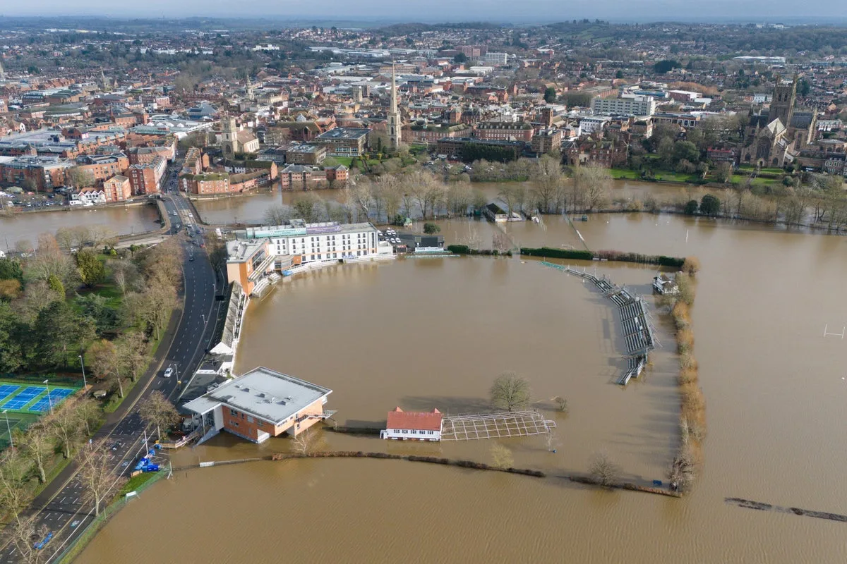
Met Office Explains Why UK Faces Relentless 2026 Rain Deluge
UK's Endless 2026 Downpours Explained by Met Office

Met Office Reveals Cause of UK's Persistent 2026 Rain Deluge

The United Kingdom has been battered by seemingly endless heavy rain throughout 2026, with the Met Office now explaining the meteorological phenomena behind the relentless downpours. According to official data, some regions have already exceeded their average February rainfall totals within just the first eight days of the month, following a record-breaking wet January that saw Cornwall and County Down in Northern Ireland experience their wettest January on record.

Widespread Flooding and Weather Warnings

The Environment Agency has issued more than 158 flood alerts alongside 99 active flood warnings, primarily concentrated across southern England, the southern Welsh border regions, and the East Midlands. Meteorological authorities have simultaneously maintained yellow rain warnings across parts of Scotland, with the agency estimating that at least 300 properties have already suffered flooding damage. An additional 170 areas remain under threat of potential flooding as saturated ground conditions persist nationwide.

Specific regions experiencing extraordinary rainfall patterns include:

  • Devon, Cornwall, Worcestershire, Somerset and West Sussex recording over 30 consecutive days of precipitation
  • North Wyke in Devon, Cardinham in Cornwall, and Astwood Bank in Worcestershire witnessing rainfall every single day of 2026 thus far
  • Plymouth, Hurn and Dunkeswell all experiencing their wettest January days in several decades

The Meteorological Mechanism Behind the Deluge

Chief forecaster Neil Armstrong detailed the complex weather patterns responsible for the persistent unsettled conditions. "The past few weeks have felt relentlessly wet, with repeated bands of rain sweeping in from the Atlantic and creating increasingly saturated ground across large parts of the UK," Armstrong explained. "This persistent unsettled pattern has been driven by a strong, south-shifted jet stream steering low-pressure systems directly towards the UK."

The forecaster further elaborated that cold air plunges across North America have strengthened temperature gradients across the northwest Atlantic, thereby energising the jet stream. Simultaneously, a "blocking high" pressure system over northern Europe has prevented weather fronts from clearing the UK, causing them to stall over the country and resulting in continuous waves of rain, strong winds, and hill snow across Scottish regions.

Ongoing Disruption and Official Warnings

Eastern Scotland faced particular disruption on Tuesday with forecasts predicting 15 to 30mm of rainfall widely and 40 to 60mm possible over higher ground. Andrew Hitchings, the Environment Agency's flood duty manager, urged continued public vigilance: "With another band of rain on its way, we need the public to remain vigilant to the risk of flooding."

Hitchings highlighted specific concerns including significant groundwater in Dorset and Wiltshire, river flooding risks on the Somerset Levels, and minor river flooding impacts expected in the East Midlands and probable in Worcestershire and Gloucestershire. "So far more than 16,000 homes and businesses have been protected but sadly 300 have suffered flooding and our thoughts are with those communities affected," he stated, while warning that driving through flood water remains extremely dangerous.

Senior operational meteorologist Simon Partridge confirmed the unsettled pattern would continue: "The weather is set to remain unsettled throughout the remainder of the week with further spells of wet and windy weather for many areas of the UK. With so much rain having already fallen over parts of the UK this year, many areas are sensitive to further rainfall. Therefore, further rainfall warnings are likely as the week progresses." Partridge noted there is currently no indication of any prolonged dry weather emerging within the next seven to ten days.