Millions of Britons are set to face a severe wintry onslaught as advanced weather forecasting models predict a five-day Arctic blast bringing snowfall rates of up to 10cm per hour to parts of the country.
Detailed Five-Day Snow Timeline
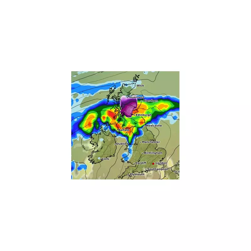
The latest GFS weather model maps indicate a prolonged period of disruptive weather sweeping across the UK between November 13 and November 17. The most intense snowfall is expected to batter northern regions, with Scotland facing the initial brunt of the wintry conditions.
On November 13 at 6pm, heavy rain is forecast to move across Scotland, Northern Ireland and parts of northern England, particularly around Newcastle. The Scottish Highlands, especially areas near Inverness and Aberdeen, could experience snow falling at rates reaching 5cm per hour. Edinburgh may see a mixture of sleet or wet snow, while southern regions should remain dry.
Widespread Disruption Expected
By November 14 at 6am, several centimetres of snow are predicted across parts of the Highlands. Other Scottish areas including Aberdeen and Edinburgh are set for rain, alongside wet weather in Newcastle, Belfast, Birmingham, Cardiff and Plymouth. London appears likely to avoid these initial downpours.
The situation intensifies on November 15 at 6am, when maps show heavy rain and strong winds battering much of the country. Downpours will sweep through Northern Ireland and northern England, while the Highlands from Inverness to Wick face proper wintry conditions with snow likely over higher ground. Southern England, including London, Birmingham and Cardiff, should experience milder conditions.
Peak Intensity and Southern Movement
On November 16 at 6am, the focus shifts as icy conditions move southward, potentially affecting Liverpool and Manchester while the Highlands see reduced snowfall.
The most severe conditions are forecast for November 17 at 12pm, when remarkable snowfall rates of 8 to 10cm per hour could strike Northern Ireland and southern and central Scotland, including areas south of Edinburgh and Glasgow. Northern England, particularly regions near Newcastle, may also experience this intense wintry blast.
The Met Office's long-range forecast from November 12 to 21 suggests: "The start of this period is likely to be largely unsettled and mostly mild, with bands or areas of rain moving across most parts of the UK, although tending to be focused more on western and possibly southern parts. Locally strong winds may also accompany the rain at times."
The forecast adds: "From around the middle of the month, we may see a transition towards more generally drier weather across the UK, and with this it is likely to turn a little cooler overall, with a greater risk of overnight frost."
This significant Arctic blast represents one of the first major winter weather events of the season, prompting authorities to advise residents in affected regions to prepare for potential travel disruption and hazardous conditions.