
The UK could see its hottest temperature ever recorded this week, with weather maps suggesting the mercury may rise as high as 42C. The current record of 40.3C was set during the July 2022 heatwave. Data now indicates that the ongoing heatwave could surpass that by almost 2C.
The Met Office has issued rare amber and red weather warnings across England and Wales, with some regions expected to reach 40C on Wednesday and Thursday. The UK Health Security Agency has also issued red heat health alerts for England, warning of severe impacts on the general population.
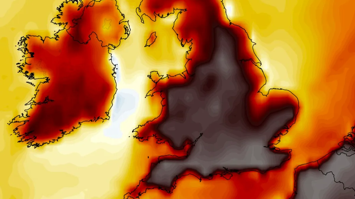
According to the UKV weather model, 40C highs are possible in south-west England on Wednesday, with temperatures in the high 30s across southern, central and eastern England. Thursday is forecast to be even warmer, with 42C possible in north-west England, eastern England, South Yorkshire and Nottinghamshire. In total, 24 counties could reach the 40C mark.

The Met Office has warned of extremely humid conditions, with dew points reaching around 22C, compared to single digits during the 2022 heatwave. Widespread 'tropical nights' are expected, with temperatures unlikely to drop below 20C overnight in southern parts of England, especially in urban areas.
Met Office Deputy Chief Forecaster Mark Sidaway said: “Red warnings are reserved for the most severe events and we’re expecting severe and significant impacts from this heatwave, with health impacts likely for many, even beyond those who are normally more vulnerable to the heat. The last time the UK recorded temperatures this high was in July 2022, but on this occasion the heat is expected to be accompanied by high humidity.”


