
Advanced weather modelling maps indicate a significant snow event is heading to the UK, with several major cities at risk, including London. The GFS weather model shows snow moving across Scotland on Tuesday afternoon, hitting Glasgow and Edinburgh, before spreading southward into northern England. By Wednesday morning, snow is expected to impact Northern Ireland, Wales, the Midlands, and even the south-east of England.
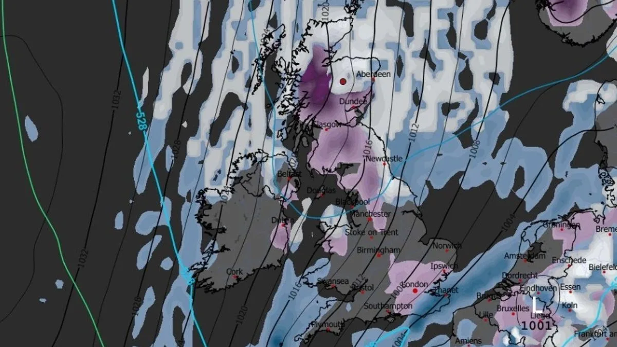
Snow coverage maps for Wednesday afternoon show settled snow in London, Ipswich, Greater Manchester, Newcastle, Glasgow, Edinburgh, Dundee, and Aberdeen, among other locations. Accumulations could reach up to 18cm on high ground in Scotland, while the Pennines in England may see up to 9cm. However, snow depths in major cities and towns are expected to be less than 1cm.
Widespread snow is predicted to subside by Thursday, though some flurries may persist in the North York Moors, north-east England, and north-east Scotland. BBC Weather has forecast “wintry showers” in places over the coming week, with Tuesday bringing showery rain that turns wintry on northern hills overnight. Wednesday is expected to be cold and largely dry, with coastal areas seeing wintry showers, while Thursday will remain cold with possible lingering showers in the east.

Netweather forecaster Nick Finnis noted that while Monday will be dry and sunny for many, Tuesday and early Wednesday will see an area of low pressure bringing showery rain, turning to sleet and snow over high ground in the north. He added that Wednesday and Thursday will be even colder, with wintry showers near coasts but mostly dry and sunny inland, with temperatures reaching only 3-6°C and widespread overnight frost likely throughout the week.
The Met Office has also warned of cold and snow. Deputy Chief Meteorologist Dan Holley explained that high pressure to the northwest will drive a cold northerly flow from the Arctic across the UK, bringing much colder conditions. He highlighted risks of wintry hazards such as snow and ice, with widespread frosts and temperatures dipping as low as -7°C in places, and daytime temperatures staying in single figures across the country.


