
The Japanese archipelago is facing a dual meteorological threat this week as two powerful weather systems converge on the region, prompting authorities to issue urgent warnings for residents and travellers alike.
Nakri's Direct Approach
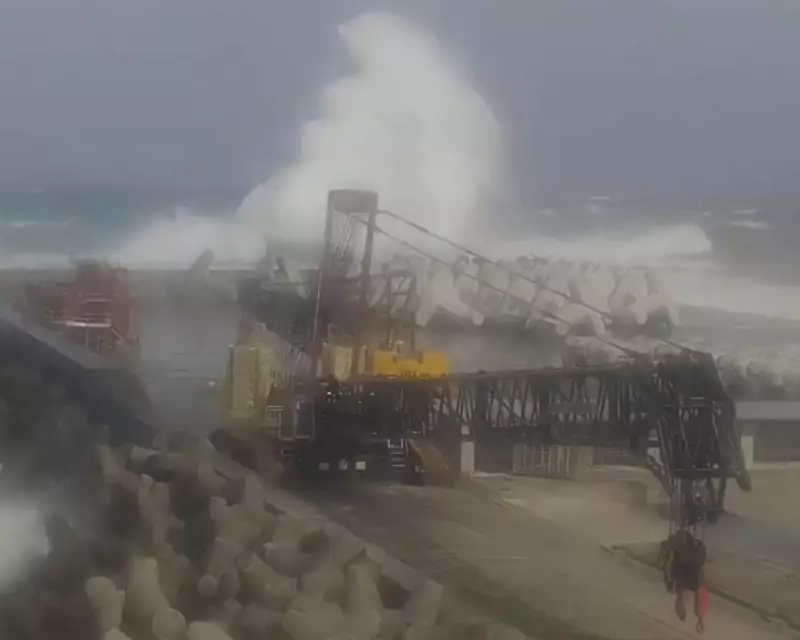
Typhoon Nakri is currently charting a course directly toward the scenic Izu Islands, a volcanic archipelago stretching south from Tokyo Bay. Meteorological data indicates the storm is intensifying as it moves northwest across the Pacific Ocean, posing significant risks to the island chain.
Weather experts are predicting torrential rainfall and potentially damaging winds as Nakri makes its closest approach. The Japan Meteorological Agency has advised residents in vulnerable areas to take immediate precautions and prepare for possible evacuation if conditions deteriorate.

Halong Gains Momentum
Meanwhile, Typhoon Halong continues to strengthen far to the east of Japan. Current projections suggest this system may develop into a more powerful storm than initially forecast, though its ultimate trajectory remains uncertain. Meteorologists are closely monitoring whether Halong will follow a similar path to Nakri or curve away from the Japanese mainland.
Regional Impacts and Precautions
The convergence of these weather systems is expected to create challenging conditions across much of eastern Japan. Coastal regions should prepare for rough seas and potential flooding, while air and sea travel may experience significant disruptions throughout the coming days.
Local authorities have emphasised the importance of staying informed through official channels and heeding evacuation orders if issued. The situation serves as a stark reminder of Japan's vulnerability to extreme weather events during the peak typhoon season.


