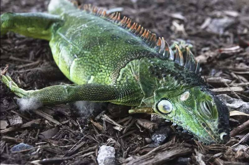
An unusual public safety alert has been issued in Florida, warning residents to beware of iguanas plummeting from trees as a powerful Arctic cold snap paralyses the reptiles. This bizarre weather-related hazard emerges as one of the season's first major winter storms grips the eastern two-thirds of the United States.
Arctic Assault Brings Record Cold
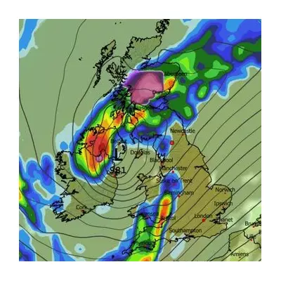
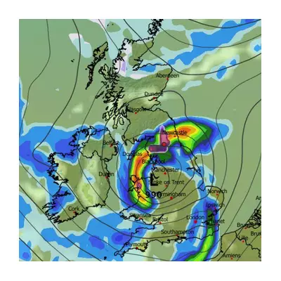
A significant blast of wintry weather is taking hold across a vast swathe of the US, stretching from the Great Lakes all the way down to Florida and Texas. Meteorologists report this surge of extremely cold Arctic air from Canada is unusual for early November and is set to break numerous temperature records.
The National Weather Service confirmed on Monday that temperatures would "tie or break many records across the south-east". The cold mass, described by CNN as a "full scale polar plunge," is making travel treacherous, particularly in Chicago and other Midwest metropolitan areas.
Dual Threats: Snow Up North, Falling Lizards Down South
While northern states brace for heavy snowfall, Floridians face a more peculiar danger. Weather experts in the Sunshine State are taking the threat of falling iguanas seriously. These cold-blooded reptiles begin to slow down when temperatures drop below 50°F (10°C) and can become completely immobilised when the mercury falls below 40°F (4.4°C).
Freezing temperatures were predicted for the northern third of Florida, reaching as far south as Gainesville. The risk is real; in January 2023, a man participating in an outdoor yoga session in Miami was actually injured by a falling iguana.
Meanwhile, in the north, a winter storm warning was in effect, cautioning of wind gusts up to 30mph combined with up to 18 inches of precipitation, creating a rare phenomenon known as thundersnow. By Monday morning, some parts of the Midwest had already seen more than a foot of snow.
Early Season Extremes and the Forecast Ahead
Chad Merrill, a senior meteorologist at AccuWeather, explained the severity of this early cold snap. "This storm pattern will introduce some of the coldest air seen for early November," he stated, noting the robust snow amounts expected in the Great Lakes.
The lake-effect snow is particularly potent due to the vast temperature difference between the Arctic air and the still-warm Great Lakes. Merrill highlighted how unusually early this snow is for major cities, pointing out that Chicago O'Hare typically doesn't see its first inch of snow accumulation until 17 January on average.
Residents of Illinois, Michigan, Indiana, and Wisconsin were forecast to experience the worst of the weather, with cold warnings also issued in Ohio, West Virginia, and Kentucky. The cold even reached the south, with some of the earliest snow on record falling in Asheville, North Carolina.
Fortunately, the snap is expected to be brief. According to AccuWeather, by Tuesday night, the lake-effect engine will start to wind down, with the cold air retreating northwards and milder air spreading east from the Great Plains.