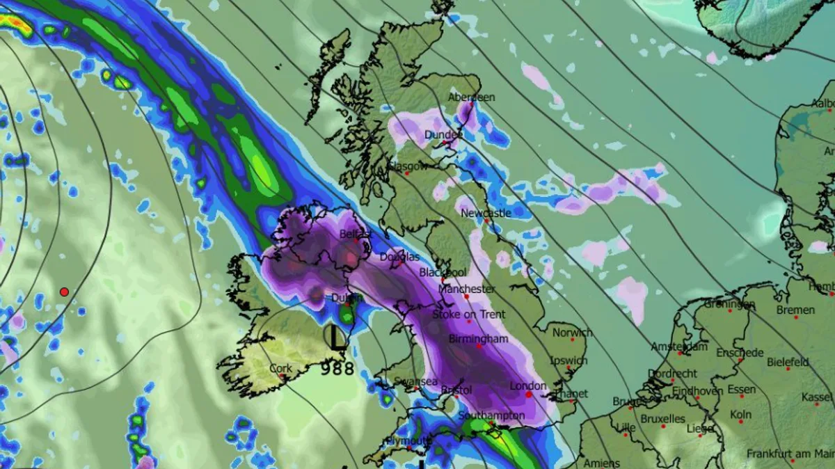
Britain is set for a dramatic return to severe winter weather, with new forecasts predicting two powerful blizzards will sweep the nation in late January, dumping up to 27cm of snow and sending temperatures tumbling to a bitter -7C.
Arctic Blast Set to End Milder Spell
After a slightly milder week offered brief respite from the freezing start to 2026, fresh weather maps indicate a significant and disruptive cold snap is imminent. Forecasters warn that hats and gloves will be essential again as an Arctic air mass collides with moisture-laden low-pressure systems moving in from the Atlantic.
Timeline of the Twin Blizzards
The first major blast of wintry weather is scheduled for Tuesday, January 27. A deep low-pressure system centred over Ireland early that morning will bring torrential rain to much of England and Wales. However, as the cold air pushes south, central Scotland is expected to see significant snowfall.
As this system moves across the UK throughout the day, it will spread further rain and snow into large parts of Scotland and Wales. Overnight into Wednesday, January 28, the initial low will clear, only to be swiftly followed by a second, potent wave of snow and rain.
A snow depth map for 9am on January 28 paints a stark picture, predicting up to 26cm of snow accumulating in central Scotland, with flurries expected across many other regions. The cold will be intense, with temperatures in the north potentially plummeting to a bone-chilling -7C.
Battle of the Weather Systems
The Met Office explains that the UK's weather will become a battleground in the coming days. A high-pressure system bringing colder conditions from the east will clash with milder, Atlantic low-pressure systems attempting to push in from the west.
In its outlook for January 21 to 30, the national weather service states: "Throughout this period, the UK will see a battle between Atlantic weather systems attempting to arrive from the west while high pressure and colder conditions attempt to exert some influence from the east."
The forecast continues: "Initially, milder Atlantic air is expected to dominate... Later in the period, there is an increased chance that conditions will turn colder. This aspect of the forecast is still somewhat uncertain but the potential transition to colder weather also increases the chance of snow across parts of the country."
Residents across the UK, particularly in Scotland and northern regions, are advised to stay updated with the latest Met Office warnings and prepare for potentially hazardous travel conditions and severe cold from January 27 onwards.