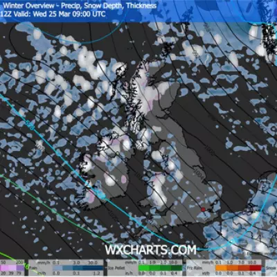
Britain is braced for a dramatic return to wintry conditions, with weather maps pinpointing this Sunday as the date for snow showers to sweep across parts of the country. The change comes after a surprisingly mild weekend, which saw temperatures peak at 11.6C in Gosport, Hampshire and 11C in Plymouth, Devon.
A Sudden Shift to Colder Conditions
The Met Office has confirmed that the weather is set to turn "more widely colder" in the coming days. While this week will remain predominantly wet and windy for most, a significant shift is expected by Sunday, marking the start of a colder spell. Steven Keates, the Met Office's deputy chief forecaster, noted the growing likelihood of colder air but highlighted some uncertainty in the models. "There are variations between the different weather models," he said, adding that while a few show very low temperatures, the majority indicate below-average temperatures from the east, though nothing too extreme at present.
Snow Maps Show Sunday's Target Areas
Detailed forecasts from meteorologists at Metdesk show snow is expected to fall as far south as Essex on Sunday morning, with the heaviest accumulations likely across Suffolk. By 9am, snowfall is predicted to be fairly heavy across parts of Essex and Cambridgeshire. The wintry conditions will also affect parts of Scotland, County Durham, and the Scottish Highlands. This initial snow is expected to turn to rain by Sunday afternoon, heaviest across Fife in Scotland. The cold snap is then forecast to bring a further chance of snow on Tuesday or Wednesday next week.
The 'Battleground' Explaining the Change
Nick Finnis, a meteorologist with Netweather, described the incoming weather pattern as a "battleground." He explained that a large high-pressure system extending from Siberia will clash with a series of low-pressure systems arriving from the west, driven by a powerful jet stream. "This may allow cold air to flood west over the North Sea from Scandinavia," Finnis wrote. He indicated that the coldest air will initially reach the north and northeast on Sunday, potentially spreading to all areas by Monday, bringing conditions cold enough for further snow.
The Mirror has reported that this Arctic snap could last for several weeks. During the initial phase, residents in the East of England, the Southeast, and parts of Scotland should prepare for disruptive wintry showers. Despite the weekend's mild peak of 11.6C, it could feel as cold as -5C in some areas on Sunday, underscoring the severity of the incoming freeze.


