
Britain is on alert for a significant winter onslaught as advanced meteorological models predict a five-day Arctic blast, bringing with it the potential for intense snowfall rates of up to four inches per hour in some regions.
Five-Day Snow Timeline: Which Cities Are in the Firing Line?
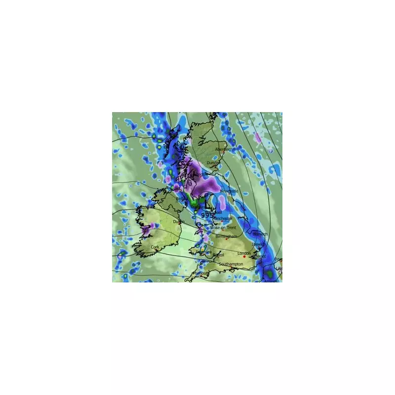
The ECMWF weather model indicates that the first scattered snow showers could arrive around midday on January 23, initially targeting parts of Northern Ireland, Wales, northern England, and Scotland. Glasgow is expected to be among the first cities to experience the wintry conditions.
The snowy weather is then projected to persist for five consecutive days. By January 24, the south-west, including Bristol, along with Wales, could see snow showers. Manchester and Aberdeen are also in line for further flurries as the cold spell holds firm in the north.

Peak Intensity: Staggering Snowfall Rates Forecast
The most severe conditions are forecast for January 26. Weather maps suggest heavy snow will become concentrated over Scotland and South Wales, where at 6am it could fall at a staggering rate of approximately four inches per hour.
Another powerful but smaller snow front is shown for January 27, threatening southern England with similarly intense snowfall rates. Coastal cities like Brighton and Southampton could see a notable covering of snow.
Snow Accumulation and the Wider Forecast
Snow coverage maps reveal the extensive reach of this cold snap. On January 24, settled snow is predicted for Wales, central and northern England, Northern Ireland, and most of Scotland. The pattern continues through to January 27.
In terms of accumulation, the data suggests the Scottish Highlands could bear the brunt with up to 32cm settling. The Lake District may see around 9cm, but most low-lying areas elsewhere are likely to see only a light dusting of 1cm to 2cm.
The Met Office's outlook for January 20 to 29 supports the potential for a colder shift. Their forecast states: "Later in the period, there is an increased chance that conditions will turn colder... This potential transition to colder weather also increases the chance of snow across parts of the country." This follows the disruption caused earlier in the month by Storm Goretti, which brought 99mph winds and 27cm of snow to some areas.


