
Britain is set for a severe bout of winter weather, with fresh weather maps predicting a powerful blizzard that could dump up to 85 centimetres of snow in some regions as an Arctic freeze grips the nation. The Met Office has issued a stark warning, highlighting an "increased chance" of widespread cold conditions and significant "wintry hazards" throughout the coming weeks.
Arctic Blast Set to Trigger Widespread Snowfall
The impending big freeze follows an already icy January, which saw the arrival of Storm Goretti. Forecasters are now monitoring a dramatic clash of weather systems. Low pressure sweeping in from the Atlantic is on a collision course with frigid air originating from the Arctic. This meteorological battle is the primary driver expected to deliver substantial snowfall across many parts of the country.
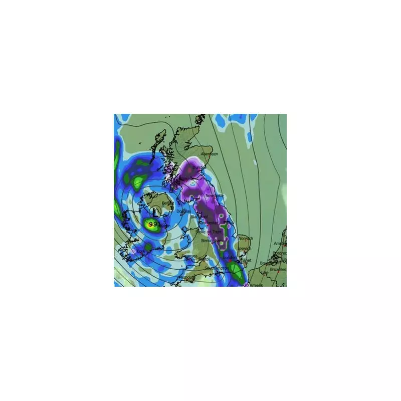
Detailed projections from weather mapping services indicate a critical period around February 1. A deep area of low pressure is forecast to settle over Ireland, acting as a catalyst for a wave of heavy snow that will sweep across the United Kingdom. The maps show vast areas, particularly in northern England and Scotland, turning a dark purple colour by 6pm that day, signifying intense snow clouds.

Deepest Snow in Scotland, Flurries to South Coast
The most extreme accumulations are anticipated in Scotland, where some locations could see snow build up to a staggering 85cm deep. However, the wintry conditions will not be confined to the north. Forecasts suggest flurries are possible all the way down to the south coast of England, indicating a nationwide impact. By 9pm on February 1, the snow clouds are predicted to shift slightly eastwards over England while remaining firmly lodged over central Scotland.
Accompanying the heavy snow will be bitingly cold temperatures. A separate temperature map for February 2 turns a deep blue, illustrating a plunge in the mercury well below zero Celsius across the nation. The coldest spot is expected to be central Scotland, where thermometers could read a bone-chilling -11°C. Remarkably, even south Wales is forecast to experience temperatures as low as -10°C around midday on February 2.
Met Office Warns of Prolonged Cold and Wintry Hazards
The Met Office's own extended outlook reinforces these concerning predictions. For the period from January 23 to February 1, the national forecaster describes a tussle between milder Atlantic air and colder, drier air from the east. While milder conditions may initially dominate, the agency states there is an "increased chance" of a subsequent turn to colder, drier weather nationwide.
This shift, though still subject to some uncertainty, significantly raises the potential for snow across many parts of the UK. Looking further ahead into February 2 to 16, the forecast grows even more stark. The Met Office predicts a weather pattern likely to bring an "increased chance of cold conditions affecting the UK, and the associated risk of wintry hazards at times."
The forecast configuration suggests low pressure to the west or southwest and high pressure to the northeast, a setup conducive to drawing cold air across the British Isles. While conditions may become more unsettled and closer to average later in February, the overarching message is clear: Britons should prepare for a sustained period of harsh winter weather, with significant snow and severe frosts on the horizon.


