The Met Office has confirmed that Storm Goretti is set to unleash widespread snow, heavy rain, and severe gales across England and Wales this week, with a new tracker revealing where the heaviest snowfall will hit.
Widespread Disruption and Snowfall Forecast
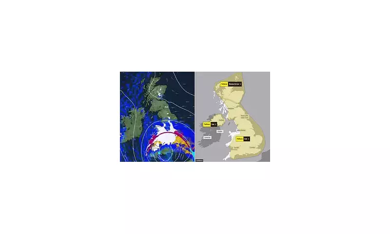
An ice warning covering the whole of Britain is in force from midnight until 10am on Wednesday, prompting warnings about treacherous roads and pavements. The storm, named by Météo-France, will then bring a significant snow event on Thursday and Friday.
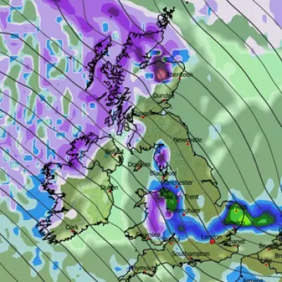
The worst of the snow is expected across the Home Counties, where up to eight inches (20cm) could settle, particularly over higher ground. Snow is likely to develop over South Wales late on Thursday before rain turns to snow more widely across England and Wales overnight.
Met Office Deputy Chief Forecaster Chris Bulmer stated the storm will clash with existing cold air, creating a 'multi-hazard' event. A yellow weather warning for snow is active from Thursday evening until Friday noon, covering most of Wales and central England, including Birmingham, Nottingham, and Oxford.
Existing Chaos and Travel Warnings
The warning comes after a week of severe wintry weather that has already caused major disruption. On Tuesday, over 1,000 schools were forced to close across the UK, with flurries reaching central London.
Transport networks have been severely impacted:
- Train services were cancelled in Scotland and England due to frozen points and obstructions.
- A bus crashed on an icy road in Liverpool.
- Drivers and walkers were trapped in deep snow in Wales, some requiring rescue by military vehicles.
The heaviest snowfall so far was recorded in Scotland, with 52cm at Tomintoul in Banffshire. Aberdeenshire Council has declared a major incident, warning of potential power cuts and communities being cut off, with all schools in the county closed on Wednesday.
What to Expect from Storm Goretti
The Met Office warns that Storm Goretti is likely to bring disruption and difficult travelling conditions. While London and the southwest may escape significant snow, strong winds on the storm's southern flank could cause further issues, leading to a separate yellow wind warning for southwest England.
The public is urged to stay updated with the latest forecasts, as the exact track of the low-pressure system remains uncertain and warnings may be amended. The key advice is to prepare for hazardous icy surfaces on Wednesday morning and significant snow disruption from Thursday night into Friday.


