
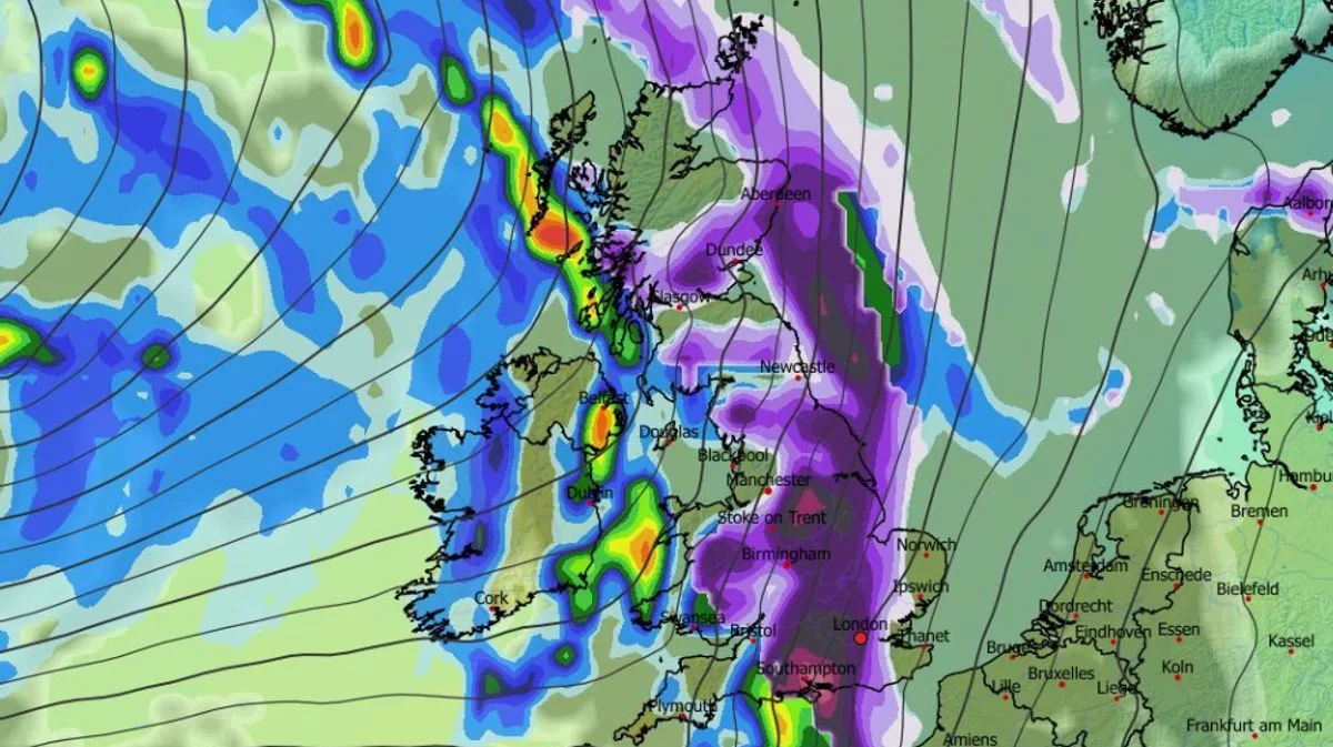
Several inches of snow could fall before the end of this week as weather maps suggest a huge blizzard is on its way to the UK, according to the GFS weather model. The snow is expected to sweep across the country on Sunday, hitting almost every inch of England, Wales, Scotland and Northern Ireland. Major cities including London, Birmingham, Cardiff, Manchester, Newcastle, Belfast and Edinburgh all appear to be in the firing line.
Flurries are first expected in Northern Ireland and western regions at around 3am on Sunday, then drift eastwards throughout the day. By 6am, heavy snow is forecast across all of Wales, most of Scotland, the north-west of England, the West Midlands, and parts of southern England. By midday, flurries are expected to hit London, Yorkshire and the north-east, with the most intense snow over Southampton. The weather front is tracked to move off into the North Sea from 6pm, passing over East Anglia.
By the end of the day, snow could be settled on the ground across roughly 90 per cent of the country. Only the south-west of England, parts of Wales and parts of Northern Ireland are likely to be spared. Snow depth charts suggest as much as 21cm (eight inches) could settle on hills in Scotland, 14cm (six inches) in northern England, and 5cm (two inches) in the Midlands and parts of Wales.

The Met Office says "colder conditions" could impact some parts of the UK later this month. Its forecast for February 14 to 23 states: "After a briefly quieter spell, associated with some colder conditions, Atlantic frontal zones look to make a return near the start of this period. The track of these depressions may be a little further north than over the preceding weeks, but will continue to bring broadly unsettled weather to many areas, with further spells of rain and perhaps strong winds at times."
BBC Weather's forecast for next week adds: "The week may start cold with some wintry showers, but atmospheric patterns could shift again. High pressure to the north will most probably weaken and even be replaced by low pressure developing near Iceland by the end of the week. That should allow south-westerly wind flows to develop at times, bringing milder air across the UK, although Scotland may still be chillier."


