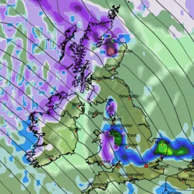
The United Kingdom is bracing for a renewed and potentially severe bout of wintry weather, with fresh weather maps indicating another significant blizzard is on course to sweep across the nation by Saturday. The impending Arctic onslaught threatens to bury cities, including London, under deep snow, with some areas forecast to receive staggering accumulations of more than 60 centimetres.
Arctic Air Collides with Atlantic Systems
The country is currently gripped by an icy spell, with numerous weather warnings for ice and snow active across the UK. Temperatures have already plunged well below freezing, with Shap in Cumbria recording a low of -10.9C on Sunday night. However, forecasters warn the mercury could drop even further as the week progresses.
The driver of this extreme forecast is a collision between entrenched Arctic air moving southwards and moisture-laden low-pressure systems arriving from the Atlantic. This volatile mix is expected to generate heavy and widespread snowfall.
Timeline of the Wintry Onslaught
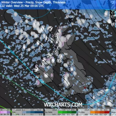
Weather modelling from WXCharts paints a detailed picture of the incoming disruption. By 9pm on Thursday, a low-pressure system is predicted to be centred off the southwest coast of England, bringing heavy rain to the south and snow flurries to northern regions.
Overnight into Friday, this system moves inland, interacting with the cold air mass and transforming precipitation into snow across southern England. A map for 3pm on Friday shows heavy snow falling, particularly across Scotland. By 9am on Friday, a wide band of snow is predicted across the south of England, with depths potentially exceeding 20cm. The most extreme accumulations, however, are forecast for central Scotland, where more than 60cm of snow could land.
Bitter Cold and Continued Blizzards
The hazardous conditions are set to continue into Saturday, accompanied by bitterly cold temperatures. Forecast maps indicate that at midday on Saturday, temperatures could plummet to -14C in Scotland and -9C in northern England. Even in the south, temperatures will struggle to rise much above 1C.
The Met Office has emphasised the ongoing risks. Chief Meteorologist Matthew Lehnert stated: “The UK will continue to experience a range of winter weather hazards through this week, with low temperatures as well as snow showers and the risk of ice for many.”
Deputy Chief Meteorologist Mike Silverstone highlighted remaining uncertainties, explaining that the exact track of the low-pressure system will determine local impacts. “The most likely scenario at this stage is for low pressure to track near the south coast. Near and south of the low, heavy rain and strong winds are more likely, whilst snow could accumulate to the north as it encounters cold air,” he said. The national weather agency has also warned that strong winds may exacerbate the disruptive conditions.
Residents across the UK, especially in major cities like London facing significant snow, are advised to stay abreast of the latest forecasts and severe weather warnings as the situation develops towards the weekend.


