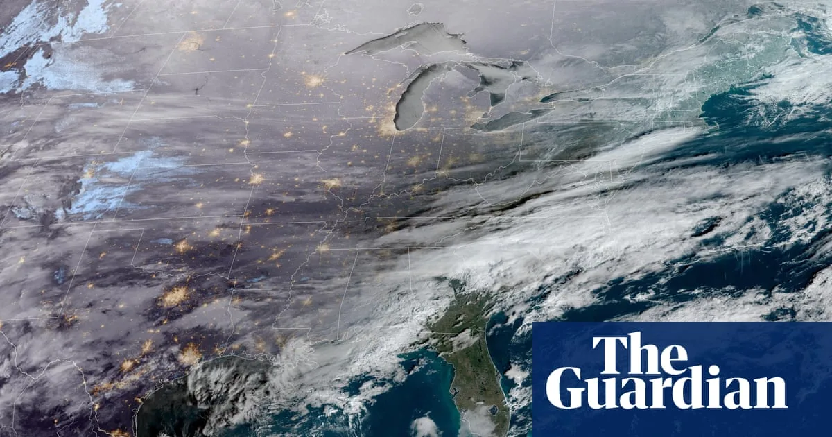
A colossal winter storm is sweeping across the United States, with 16 states and Washington DC declaring states of emergency as it threatens to bring snow, sleet, and freezing rain to the south, midwest, and east coast. At least 230 million people are expected to be affected by the system, which began forming in the Rocky Mountains and Great Plains on Friday before surging into southern and midwestern areas, then up the east coast by Sunday.
Governors in Texas, Louisiana, Mississippi, Alabama, Georgia, South Carolina, North Carolina, Missouri, Tennessee, Virginia, Maryland, Pennsylvania, New York, Arkansas, Kansas, and Kentucky have all declared emergencies, freeing up financial reserves to deal with the conditions. The mayor of Washington DC also issued an emergency declaration. The storm is expected to bring prolonged Arctic temperatures to regions unaccustomed to such cold, raising fears of power failures and supply shortages.
President Donald Trump used the storm to question climate change, posting on social media: 'Record Cold Wave expected to hit 40 States. Rarely seen anything like it before. Could the Environmental Insurrectionists please explain – WHATEVER HAPPENED TO GLOBAL WARMING???' However, scientists point out that the climate crisis is disrupting the polar vortex, causing more extreme weather events. The American Red Cross noted that while winters are getting warmer and shorter, a warmer atmosphere holds more moisture, making heavier snowfalls more likely.

Residents in several states have been stocking up on supplies such as bottled water, generators, and food, with many local media outlets sharing images of empty shelves. The American Red Cross has urged the public to prepare, while authorities in southern areas warn of prolonged electricity outages. Meteorologists have forecast snow, sleet, and significant freezing rain, which could turn roads deadly and bring down power lines.
The National Weather Service warned that snowfall totals exceeding 12 inches are likely across the Ohio valley, mid-Atlantic, and north-east. More than 100 million people are expected to endure sub-freezing temperatures until at least next Wednesday. The Federal Emergency Management Agency (Fema) has activated its National Response Coordination Center to respond to the storm, following reports that it had abruptly stopped firing staff amid plans to cut thousands of workers this year.