
Weather experts are issuing urgent warnings to Americans to cancel all travel plans this weekend as a formidable winter storm, named Winter Storm Fern, prepares to unleash its fury across multiple states. Meteorologists are describing this system as potentially one of the most significant in recent memory, with forecasts predicting up to 20 inches of heavy snow, sleet, and ice across the eastern half of the United States.
Dire Warnings from Meteorologists
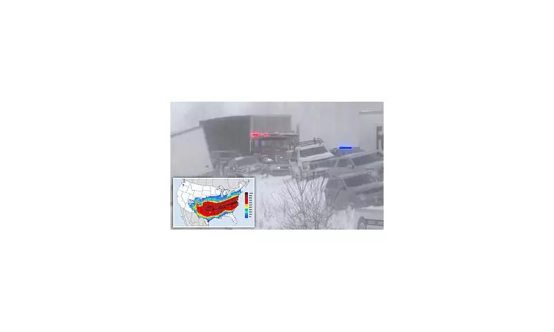
The National Weather Service has issued severe weather alerts, anticipating hazardous conditions and significantly reduced visibility throughout the upcoming weekend. Arctic air from Canada is expected to surge southward, clashing with southern stream energy to create what forecasters are calling a "high impact winter storm" across the southern tier of the country.
Jordan Steele, a meteorologist with The Weather Channel, took to social media to emphasize the seriousness of the situation. "This is not good," Steele wrote. "Plan now! Plan for going day(s) without power this weekend. School cancellations next week. Do not plan a road trip this weekend. This could be situation where people get stuck on the highway."

Confidence in Severe Impacts
Tim Buckley, a meteorologist with WFMY, expressed high confidence in what he termed "bad impacts" from the storm. Buckley noted on social media that the combination of "incredible" moisture levels and "tons of durable" cold air at the surface points toward a particularly dangerous weather event.
"Models forecasting one to two inches of liquid (usually equals 10-20 inches of snow, or three to six inches of sleet, or up to one inch of ice)," Buckley wrote, while acknowledging that precise amounts remain uncertain. The North Texas Weather Center described the approaching system as both "very serious" and "historic," stating that models show either over an inch of freezing rain or more than twelve inches of sleet and snow, with precipitation likely to persist for days as temperatures remain below freezing for extended periods.
Friday: The Storm Begins
On Friday, heavy snow, sleet, and freezing rain are expected to lash the Midwest, Southern Rockies, Plains, and Mid-South regions before beginning its eastward progression. Northern Texas, Oklahoma, and Kansas through to the lower-Mississippi Valley will experience snow and ice beginning Friday and continuing into the night.
Temperatures are forecast to plummet to approximately 30 degrees below average in parts of the Dakotas, Minnesota, Iowa, Wisconsin, and northern Illinois. Denver is expected to see temperatures in the teens, while Nashville, Oklahoma City, and New York City will hover around 30 degrees Fahrenheit. Chicago's Friday forecast predicts temperatures reaching negative six degrees, with wind chills in the upper Midwest potentially dropping between 30 and 50 degrees below zero.
Saturday: Peak Intensity
As the weekend progresses, Saturday will bring the storm's full force to areas including northern Texas, Louisiana, North Carolina, and Virginia. Dozens of locations are expected to reach record-breaking cold temperatures, with the Twin Cities anticipated to see temperatures as low as near negative 20 degrees.
Temperature forecasts for Saturday include Denver at ten degrees, Oklahoma City at five degrees, Nashville at 17 degrees, New York City at eleven degrees, and Chicago at negative eight degrees. The coldest temperatures are predicted to push toward the South and into the Northeast, with readings expected to be 15 to 30 degrees lower than seasonal averages.
Meteorologist Jesse Walker described Saturday as looking "a mess" according to radar maps. By Saturday night, the winter chaos may extend to the Texas Gulf Coast, southwestern Louisiana, central Mississippi, northern Alabama, northern Georgia, and South Carolina. Snow may intensify in mid-Atlantic states and continue across the mid-South, including Oklahoma and Texas.
Sunday: Gradual Diminishment
As Sunday arrives, snow is expected across the Northeast, with wind chills for the Northeast and New England forecast to reach below zero. Texas should see the end of winter precipitation, but it will persist for areas of Louisiana, the Tennessee Valley, Appalachians, and the Carolinas.

While heavy snow remains possible in the East, precipitation is expected to gradually diminish by Sunday night, though current forecasts remain unclear about the storm's precise progression. Snow could potentially last until Monday along the East Coast, depending on the storm's speed of movement.
Preparation and Safety Urged
Weather authorities are strongly advising residents in affected areas to take immediate precautions. Recommendations include:
- Avoiding all non-essential travel throughout the weekend
- Preparing emergency kits with food, water, and medications
- Ensuring alternative heating sources are available in case of power outages
- Checking on vulnerable neighbors, particularly the elderly
- Keeping devices charged and having battery-powered radios available
The combination of heavy precipitation, extreme cold, and potential power disruptions creates what forecasters are calling a particularly dangerous winter weather scenario that demands serious preparation and caution from all residents in the storm's path.


