
The Met Office has provided detailed explanations about an impending 'weather battleground' that is expected to bring significant snowfall to multiple regions across the United Kingdom. Meteorological experts are warning of a dramatic clash between weather systems that will result in wintry conditions affecting substantial areas, particularly as we approach the end of January.
Understanding the Meteorological Clash
According to the latest forecasts, a complex atmospheric confrontation is developing that meteorologists describe as a genuine 'battleground' scenario. This involves Atlantic storm systems pushing energetically from the west while encountering stubborn high-pressure systems extending from northern and northeastern regions.
Nick Finnis, a meteorologist with Netweather, elaborated on this developing situation in a detailed blog post. He explained that the conflict arises between "a large high pressure system extending west from Siberia and a queue of lows coming in from the west." This atmospheric struggle is being driven by "an increasingly powerful jet stream moving east out of the Eastern Seaboard of North America across the North Atlantic and on into western Europe."

Regional Impacts and Snowfall Predictions
The Met Office's ten-day forecast specifically highlights that wintry showers will become increasingly likely as temperatures drop during the coming week. The national weather service indicates that weather systems moving from the Atlantic will "continue to attempt to push in from the west, but tending to stall in the vicinity of the UK as they encounter high pressure to the north and northeast."
This meteorological standoff is expected to produce "further spells of rain or showers" that may be "heavy and persistent, especially in the south and west." However, the most significant development will be the turn toward colder conditions that brings "the risk of some snow showers, most likely across hills in Scotland and northern England."
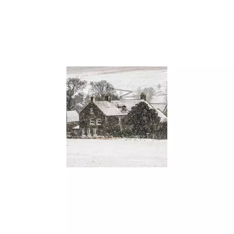
The forecast specifically identifies northern England regions such as the North York Moors and various parts of Scotland as areas most likely to experience substantial snowfall. This comes as temperatures are anticipated to drop significantly from recent milder conditions that saw readings exceed 10°C in locations including Gosport in Hampshire and Santon Downham in Suffolk.
Temperature Drops and Additional Concerns
Meteorological models suggest temperatures could plummet to as low as -6°C in North Yorkshire by Wednesday, with easterly winds expected next week that will make conditions feel even colder. This represents a dramatic shift from the relatively mild conditions experienced recently across much of the country.
Beyond the snowfall predictions, there are additional weather-related concerns developing across the UK. Multiple flood warnings remain in place, including several across the Southwest of England. There is growing apprehension that additional precipitation—whether as snow or rain—could lead to already saturated waterways becoming overwhelmed.
Specific areas of concern include the River Yeo from Sherborne to Yeovil in Dorset, where water levels are already high, and the River Nene east of Peterborough. These conditions follow earlier winter weather events that saw families enjoying sledging opportunities in locations like Bannau Brycheiniog National Park (formerly known as the Brecon Beacons) after snowfall at the beginning of January.
The developing weather pattern represents a significant shift in conditions as we move deeper into winter, with meteorological experts closely monitoring how this 'battleground' scenario will unfold across different regions of the United Kingdom in the coming days.


