
Britain is on alert for two rare and potentially dangerous winter weather phenomena expected to strike at the start of February. Fresh weather maps indicate a significant risk of freezing rain and ice pellets sweeping across parts of the country, bringing fresh travel hazards and icy conditions.
Forecast Details and Affected Regions
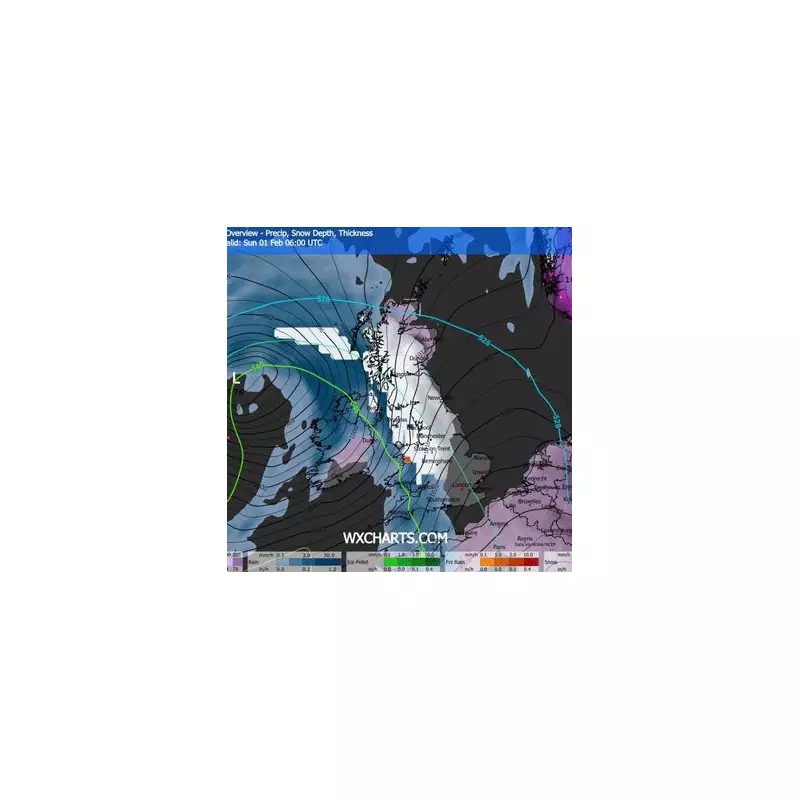
According to GFS model projections, the UK could experience these hazardous conditions on Saturday, February 1. The maps suggest around half an inch of snow may fall from the early morning, with a band of the heaviest snow initially affecting the West Midlands and the north-west, stretching up towards Belfast and Glasgow.
Lighter snow is forecast for the north-east, while the first pockets of freezing rain – depicted in orange on the charts – are predicted for Snowdonia. As the morning progresses, slightly thicker snow could spread to the north-east, the East of England, and eastern Scotland. Further dangerous patches of freezing rain are expected to develop over the Peak District and around Ayr.

Understanding the Rare Hazards
The forecast also shows ice pellets, marked in green, potentially appearing near Carlisle and the Scottish Borders. By midday, the models indicate snow being pushed north towards eastern Scotland, with rain replacing it across most of the UK except London and parts of the south-east. Additional freezing rain is possible around Loch Lomond and Northumberland.
The Met Office's long-range forecast for the period from January 24 to February 2 supports this outlook, stating conditions will "turn somewhat colder through this period, bringing the risk of some snow, more especially on hills in Scotland and northern England".
Why Freezing Rain and Ice Pellets Are So Dangerous
Freezing rain is a particularly hazardous event. It forms when snow falls through a layer of warm air, melts into rain, and then passes through a sub-zero layer of air near the ground. The droplets become 'supercooled' – remaining liquid despite being below freezing – and instantly freeze upon contact with any surface.
This creates a clear, smooth glaze of ice on roads, pavements, and power lines. The Met Office warns it is "extremely hazardous" for aircraft, road vehicles, and pedestrians. The weight of the ice can also rapidly accumulate on tree branches and electricity cables, causing them to snap.
Ice pellets, sometimes called sleet, are grain-like particles that form when snowflakes partially melt and then re-freeze before hitting the ground. They can accumulate in a dense layer, similar to snow, and often bounce on impact. While generally smaller than hailstones, they can create slippery underfoot conditions and reduce visibility.
Authorities are urging the public to monitor forecasts closely as the date approaches, given the significant disruption and safety risks associated with these uncommon winter weather events.


