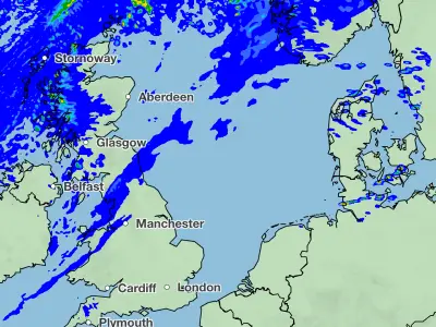
Storm Ingrid Map: 60mph Winds and Heavy Rain to Batter Britain This Weekend
The Met Office has issued multiple yellow weather warnings across the United Kingdom as Storm Ingrid descends upon the nation, bringing with it powerful winds and persistent heavy rainfall. The storm, which was officially named by the Portuguese national weather service IPMA, is set to create significant disruption throughout the weekend, particularly in Scotland, Wales, and south-west England.
Widespread Weather Warnings and Flooding Risks
Forecasters have warned that rainfall accumulations of 30 to 60mm are likely fairly widely inland, with the potential for 80 to 120mm over the highest ground exposed to brisk south-easterly winds. Given the already saturated ground following recent rain and snow thaw, this precipitation presents a serious flooding risk in many areas.
The Met Office has explicitly cautioned that there is a "small chance of fast-flowing or deep floodwater causing danger to life." In response, the Scottish Environment Protection Agency has issued an extensive alert system, including 22 flood warnings and four flood alerts across the region.
Scotland Braces for Further Disruption
In Scotland, a yellow weather warning for rain remains in effect until Sunday morning, covering numerous regions including:
- Angus and Dundee
- Northern Fife and Aberdeen
- Aberdeenshire and parts of the Highlands
- Moray, Perth and Kinross, and Stirling
The impact is already being felt across the country. Perth and Kinross Council reported that many roads in the region were closed due to flooding as of 6am on Friday. Significant closures include the A94 between A93 Meikleour crossroads and A923 Bendochy crossroads, along with the Queen's Bridge in Perth.
On the railways, ScotRail has implemented speed restrictions on several key routes:
- Inverness to Edinburgh/Glasgow/Aberdeen lines
- Glasgow to Dumfries route
- Stranraer to Ayr/Kilmarnock connections
- Glasgow to Mallaig/Oban services
Emergency services have already been called into action, with firefighters rescuing three people from stranded vehicles in Aberdeenshire. Two individuals were saved from a minibus on the B977 near Kintore at approximately 8.30am on Thursday, while another person was brought to safety from a car in a separate incident near Banchory around the same time.
South-West England and Wales Face Powerful Winds
Meanwhile, a separate yellow warning for both wind and rain is in effect from Friday to Saturday for parts of south-west England and southern Wales. Forecasters predict gusts of 45 to 50mph widely inland, with the potential for these to reach up to 60mph near coastal areas. The winds are expected to peak during Friday evening before gradually easing overnight and into Saturday morning.
The affected areas in this region include:
- Cornwall, Devon, Dorset and the Isles of Scilly
- North Somerset, Plymouth, Somerset and Torbay
- Blaenau Gwent, Bridgend, Caerphilly and Cardiff
- Carmarthenshire, Merthyr Tydfil and Monmouthshire
- Neath Port Talbot, Newport, Pembrokeshire and Powys
- Rhondda Cynon Taf, Swansea, Torfaen and Vale of Glamorgan
Coastal Safety Warnings Issued
The Met Office has issued specific safety guidance for those living near or visiting coastal areas during the stormy conditions. Forecasters have emphasised that "even from the shore large breaking waves can sweep you off your feet and out to sea."
They advise walkers to take particular care near cliffs, ensuring they know their route and keep dogs on a lead. In case of emergency, the public is reminded to call 999 and ask for the coastguard.
As Storm Ingrid continues its path across the UK, authorities are urging residents to stay informed about local weather updates, avoid unnecessary travel, and prepare for potential disruption to transport networks and local services throughout the weekend.