
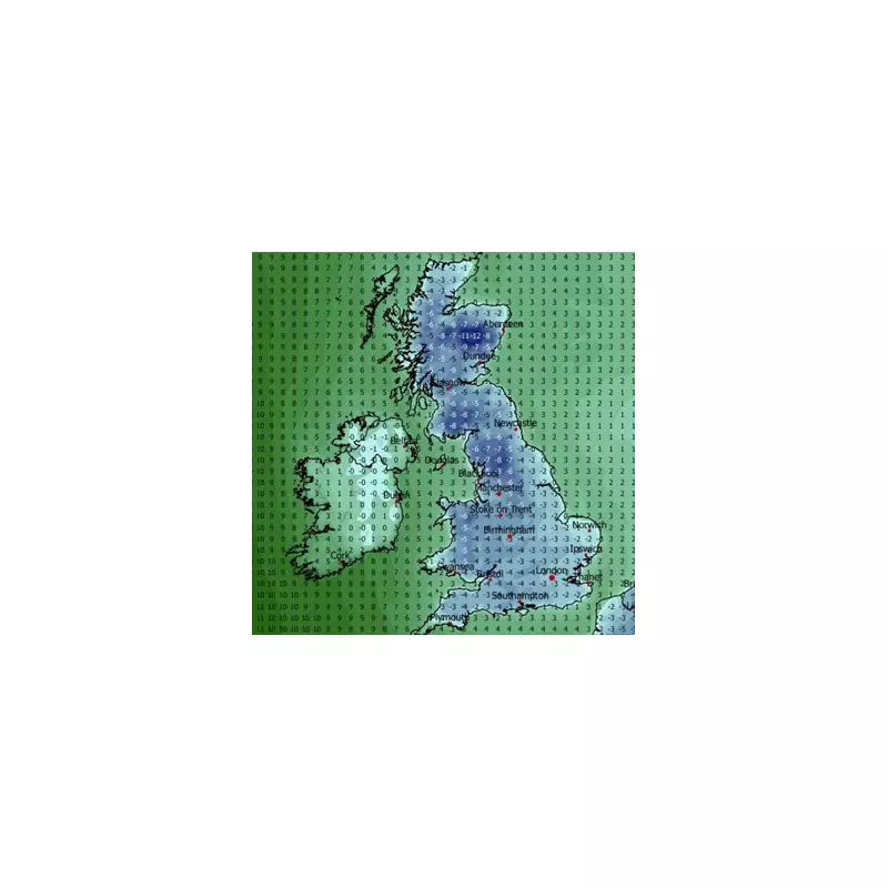
Britain is on alert for a potential Arctic blast later this month, with forecasters warning a major Scandinavian weather system could bring significant snow and plunging temperatures. The cold snap, which could see the mercury drop as low as -12C, is predicted to arrive from January 26 onwards, threatening to bury parts of the country in a deep freeze.
The Scandinavian Blocking System Explained
According to Netweather forecaster Ian Simpson, the culprit is a Scandinavian blocking system. This is a slow-moving area of high pressure that forms over Scandinavia and effectively blocks the usual Atlantic weather patterns from reaching the UK. Simpson indicates this setup has a 30 to 40 per cent chance of developing into a snowy easterly flow during the period. He writes that it could lead to "a spell of generally colder and drier weather for the British Isles," but cautions there are "no guarantees."
The forecast identifies eastern areas of the UK as the regions most likely to see any significant snowfall if the system develops as predicted. However, Simpson adds that the odds currently favour a scenario that is "fairly cold but predominantly dry with little or no snow," noting that more unsettled weather from the west remains possible.

Met Office and BBC Align on Colder Outlook
The national forecaster, the Met Office, supports the possibility of a dramatic temperature drop. In its forecast for January 20 to 29, it describes a looming "battle" between milder Atlantic systems and colder air from the east. It states: "Later in the period, there is an increased chance that conditions will turn colder. This aspect of the forecast is still somewhat uncertain but the potential transition to colder weather also increases the chance of snow across parts of the country."
Similarly, BBC Weather notes that high pressure near Scandinavia could strengthen and build towards north-west Europe. This would act as a barrier, deflecting Atlantic systems and potentially allowing "colder easterly flows" to develop by the end of the week commencing January 19. The BBC forecast warns these could bring "wintry showers" in off the North Sea, but also notes the milder Atlantic influence may still win out, particularly in western regions.
Uncertainty Remains Amid Freezing Predictions
While weather maps from sources like WXCHARTS suggest the potential for snow around January 29 and 30, all forecasters emphasise the significant uncertainty in the outlook. The key question is whether the Scandinavian high pressure will be strong enough to dominate the UK's weather, or if the more typical, milder westerlies will prevail.
If the blocking high takes hold, the UK faces a period of notably colder weather with the distinct risk of disruptive snow, especially for eastern counties. The public is advised to stay updated with the latest forecasts from the Met Office as the situation becomes clearer in the coming days.


