
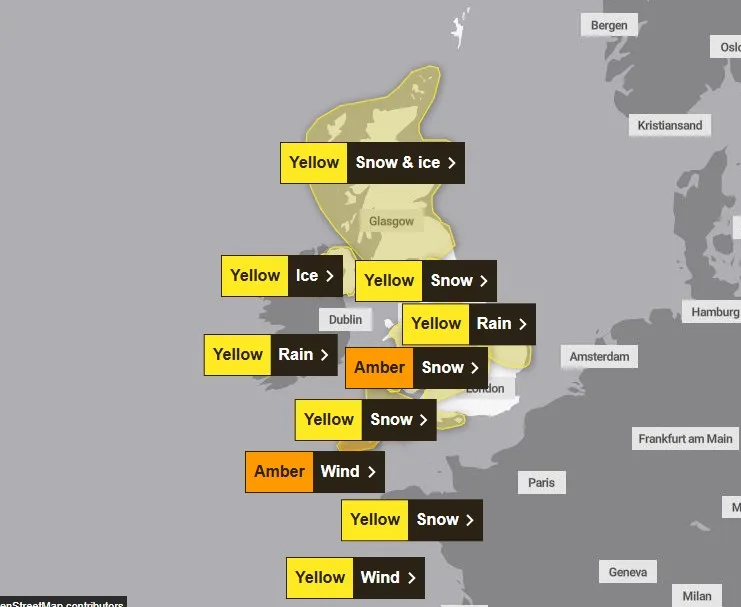
The UK is bracing for heavy snow and winds of up to 90mph as Storm Goretti hits, with amber “danger to life” warnings in place for large swathes of the country. Amber weather warnings for heavy snow cover the Midlands, Yorkshire and the Humber, South West England and Wales, while Cornwall faces amber wind alerts for gusts of 80 to 90mph from 8pm on Thursday, with large waves and flying debris posing a potential “danger to life”.
Yellow weather warnings for snow, ice and rain are in place for the majority of the UK from Thursday to Friday. London is forecast to see spells of rain and blustery conditions, but is expected to miss the worst of the severe weather affecting other parts of the UK, including heavy snow.
Met Office chief forecaster Neil Armstrong described Storm Goretti, named by Meteo France, as a “multi-hazard event”, bringing heavy rain, strong winds and snow. As much as 30cm of snow could fall in the Midlands while gusts of up to 90mph could batter more exposed coastal areas.

Amber warnings have an "increased likelihood of impacts from severe weather" compared to yellow warnings, meaning there is the possibility of travel delays, road and rail closures, power cuts and potential risk to life and property. The snowfall will mean trains and planes could be delayed or cancelled, rural communities may be cut off, and power cuts and disruption to mobile signal are likely.
National Highways issued its own amber warning for snow in the West and East Midlands, which lasts from 6pm on Thursday until 9am on Friday. Drivers were also warned that the A628 Woodhead Pass would be closed both ways between the A616 at Flouch and the A57 at Hollingworth from 8pm on Thursday due to the severe weather.
Amber cold weather health alerts have been issued by the UK Health Security Agency until January 11, meaning severe impacts across health and social care services are expected. Officials expect a rise in deaths, particularly among those aged 65 and over or with health conditions, with impacts also possible on younger age groups.


