
The state of Nevada has been rattled by a series of tremors in a geologically restless region where the planet's crust is slowly being torn asunder.
Details of the Seismic Events
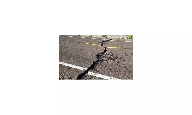
The United States Geological Survey (USGS) recorded two distinct earthquakes on Monday. The seismic events measured magnitudes of 3.5 and 3.8, with the most recent tremor occurring at 11:08am Pacific Time (2:08pm Eastern Time). The epicentre was located close to the area of Empire, Nevada.
The Geological Forces at Play
This activity is centred within the vast Basin and Range Province, a distinctive geological region that covers much of the western United States. Here, the Earth's crust is undergoing a gradual process of extension, being stretched and thinned over immense timescales.

As the crust pulls apart, it creates fractures known as faults. The movement and release of stress along these fault lines are what generate the earthquakes felt at the surface. The town of Empire lies within a zone heavily influenced by major fault systems, most notably the Walker Lane zone.
This zone is a significant strike-slip fault system that plays a crucial role in accommodating the motion between two of the Earth's massive tectonic plates: the Pacific Plate and the North American Plate.
A History of Seismic Unrest
The region is no stranger to substantial seismic activity. This latest incident follows a much larger event that serves as a potent reminder of the area's volatility. In 2020, a powerful 6.5-magnitude earthquake shook Nevada, an event scientists believe was directly caused by the ongoing cracking and stretching of the Basin and Range Province.
This is a developing story. Further updates will follow as more information becomes available from geological authorities.


