The Met Office has issued a stark warning of an impending 'weather war' over the United Kingdom, with a dramatic climatic clash set to unfold in the coming days. Forecasters predict a fierce battleground between mild air sweeping in from the Atlantic and bitterly cold conditions pushing from the east, significantly raising the risk of widespread snow and a sharp temperature drop by the end of January.
The Impending Climatic Clash
Meteorologist Greg Dewhurst indicated that the coming days will mark a critical turning point in the nation's weather. He stated that from next weekend and into the following week, a direct confrontation is expected. The UK will see a battle between Atlantic weather systems attempting to arrive from the west while high pressure and colder conditions attempt to exert some influence from the east.
This forecast follows the chaos caused earlier this month by Storm Goretti, a severe 'multi-hazard event' that brought gusts of almost 100mph, triggered a rare red weather warning, and led to tragic consequences, including the death of a man in his 50s in Helston, Cornwall.
From Mild to Mayhem: The Snow Threat
Initially, milder Atlantic air is expected to dominate, bringing typical unsettled conditions with showers. However, the balance is poised to shift dramatically. A Met Office spokesperson emphasised the growing uncertainty and risk, noting: This aspect of the forecast is still somewhat uncertain but the potential transition to colder weather also increases the chance of snow across parts of the country.
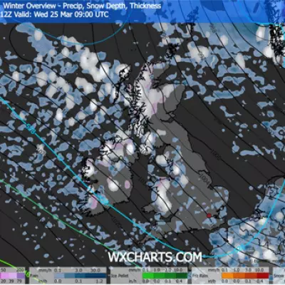
Detailed data from WXCharts suggests the timing of a potential cold blast, ominously referred to as a 'Beast from the East', with Arctic air threatening to invade from mid-week next week. The models indicate snow could first arrive in the early hours of January 27, initially affecting Wales, Scotland, and Northern Ireland before spreading rapidly south and east.
Potential Snowfall and Temperature Plunge
The snowfall may intensify through the day on the 27th, falling at rates up to 0.4 inches per hour. Forecasters warn of another significant snow event on January 29, which could blanket the UK 'from tip to tail'—a stretch of over 600 miles—with accumulations of up to two inches in many areas. By the early hours of January 30, only London, parts of the east coast, far west Devon, and limited areas of south Wales might escape the snow.
Accompanying the snow will be a severe temperature drop. Overnight lows are forecast to plunge to between -1C and -6C across England, around -5C in Wales, and as low as a frigid -12C in parts of Scotland, particularly near Inverness where snow is expected to settle firmly.
A Note of Caution from Forecasters
Despite the alarming projections, the Met Office urges public caution, stressing that the deep freeze is not yet a certainty. A spokesperson, Grahame, provided a balancing perspective: In the immediate future colder weather isn't expected to return for the UK. Temperatures for most of next week should remain near average.
He added that while easterly winds could bring a chill in the final week of January, the forecast could still change, and it remains just as probable that milder southern air will persist, keeping the extreme cold at bay. The nation is now watching closely to see which force will win this meteorological war.


