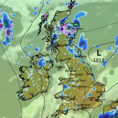
The Met Office has identified two areas of the UK that could see snow within hours, as a deep freeze brings temperatures down to -5C overnight. The national weather agency expects most places to remain dry today with variable cloud and sunny spells, but northern regions will experience showery outbreaks of rain and cold conditions.
Snow in the Northern Isles
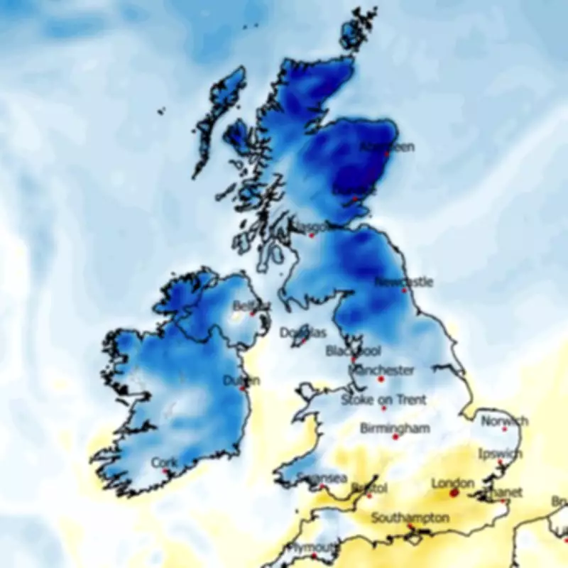
According to the Met Office, cloud and patchy rain will move southward tonight, while Scotland faces blustery showers. These showers could fall as snow in the Northern Isles, including Orkney and Shetland, this evening. Temperature anomaly maps show deep blue areas across Scotland, Northern Ireland, and northern England, indicating temperatures well below the seasonal average.
Overnight Lows
Temperatures could plummet to -5C overnight in northern areas, with lows of 0C expected in the south. For tomorrow, most places will remain dry with patchy cloud and sunny spells, but a few showers may break out across Northern Ireland, Wales, and southwest England. Overnight lows are forecast at -4C in the north and -2C in the south.

Improvement Later This Week
Thankfully, conditions are expected to turn warmer later this week. The Met Office forecast for Thursday to Saturday indicates largely dry weather at first with some sunny spells and fairly cool temperatures. There is an increasing chance of showers on Friday and possible rain in the south on Saturday, but overall temperatures will rise.
BBC Weather Outlook
BBC Weather adds that Thursday will see areas of cloud and showers develop from the west, while eastern parts stay mostly dry with sunny spells. It will be windy in the north-west. Friday looks unsettled with variable cloud and scattered showers, with more widespread rain spreading across the south overnight into Saturday, turning lighter as it pushes north. The north will remain mostly dry.