
Met Office Activates 'Danger to Life' Amber Alert Across Nine Scottish Regions
The Met Office has escalated weather warnings across the United Kingdom, placing nine specific areas under an amber alert that carries a stark 'danger to life' designation. This urgent advisory comes as forecasters predict a potent mix of heavy rainfall and disruptive snowfall, set to impact large swathes of the country over the coming days.
Widespread Unsettled Conditions and Disruptive Impacts Forecast
Meteorologists have highlighted the return of widely unsettled conditions for much of the UK, with northern regions, particularly around Scotland, expected to bear the brunt of the severe weather. An amber weather warning was issued this morning, alerting residents to persistent and hazardous conditions that are likely to cause significant disruption for at least the next twenty-four hours.
The agency has emphasised that the main threats stem from persistent and heavy rainfall, which could lead to substantial surface water and river flooding. Forecast models indicate widespread accumulations of 60 to 80 millimetres are probable, with some elevated areas potentially seeing totals between 100 and 120 millimetres. Event totals since Wednesday evening may even exceed 150 millimetres in isolated locations.

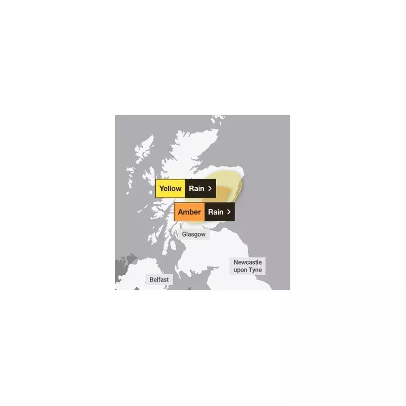
Snow Adds to Weather Uncertainty and Prolongs Hazard Period
While the amber warning is active for an eighteen-hour period from midnight on Thursday until 6pm the same day, the risk of wintry precipitation extends further. A separate yellow warning for rain, which is already in effect over Scotland, will remain until 11.59pm on Friday. This advisory notes that the intermittent rain will become more persistent and heavy, especially over high ground.
Critically, the Met Office has stated that this rainfall will increasingly fall as snow over higher elevations, particularly on Thursday and into Friday. This transition adds a layer of complexity and uncertainty to the flooding risk, as it may affect how quickly rivers respond downstream. The yellow warning cautions that rainfall accumulations of 30 to 60 millimetres are likely inland, with 80 to 120 millimetres possible over the highest ground.
List of Regions Under the Met Office Amber Weather Warning
The nine areas specifically cited within the Met Office's amber warning are as follows:
- Central, Tayside and Fife
- Angus
- Dundee
- Fife
- Perth and Kinross
- Stirling
- Grampian
- Aberdeen
- Aberdeenshire
- Moray
- Highlands and Eilean Siar
- Highland
The amber warning explicitly indicates a greater likelihood of medium-level impacts, primarily due to river flooding. In contrast, the broader yellow warning covers a more extensive geographical area and a longer timeframe, reflecting the widespread nature of the unsettled weather pattern.
Additional Hazards from Coastal Winds and Saturated Ground
Beyond the immediate rainfall and snow threats, the Met Office has flagged additional hazards. Coastal areas, while expecting smaller rainfall totals, face risks from strong onshore winds and large waves. Furthermore, the ground's current state, following recent rain and snow thaw, is already saturated. This condition heightens the potential for flooding as the new precipitation arrives.
Residents in the affected regions are urged to stay informed through official Met Office updates and to prepare for possible travel disruptions, power outages, and the serious flooding risks highlighted by the 'danger to life' warning.


