
UK Braces for 12-Hour Blizzard as Arctic Freeze Intensifies
The United Kingdom is preparing for another severe Arctic freeze, with weather forecasts predicting a 12-hour blizzard that could see temperatures plummet to a bone-chilling -8 degrees Celsius. Heavy snow is expected to sweep across large parts of the country, creating hazardous conditions and significant disruption.
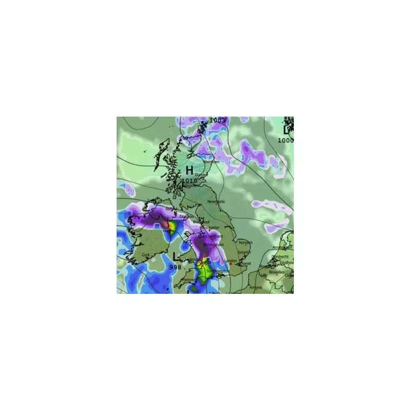
Detailed Timeline of the Approaching Storm
Meteorological charts indicate that a powerful low-pressure system will move in from the Atlantic Ocean on the evening of January 30. This system is forecast to arrive from the southwest at approximately 6:00 PM, initiating a prolonged period of intense snowfall. The interaction between this Atlantic moisture and the existing cold Arctic air mass is what will generate the substantial snow accumulations.
The initial impact will be felt most acutely over Wales and the West Midlands, where the snow is predicted to be heaviest. Meanwhile, coastal areas in the south are more likely to experience heavy rainfall during this initial phase. Overnight, the low-pressure system is expected to track across central regions of the UK.

Key Areas Affected and Expected Snowfall
The Midlands are anticipated to bear the brunt of the heaviest snow, with significant accumulations expected. By midnight on January 30, the snowfall is also forecast to reach the capital, London. Concurrently, flurries are predicted for northern parts of Scotland. A high-pressure zone to the north of the country will reinforce the cold conditions, facilitating the dramatic temperature drop.
As the storm continues its eastward trajectory, the focus will shift by 6:00 AM on January 31. After a full 12 hours of the blizzard, the most intense snowfall is then due to affect the south-east of England, including areas around London, as the low-pressure system moves further east.
Broader Weather Outlook and Official Warnings
The Met Office has issued a broader forecast, indicating a gradual cooling trend across the UK from January 25 to February 3. Weather systems from the Atlantic will continue to approach but are likely to stall near the UK due to high pressure to the north and northeast. This pattern is expected to result in further spells of rain or showers, which could be heavy and persistent, particularly in southern and western regions.
The agency notes that while milder conditions may occasionally reach the south and southwest, the overall trend will be towards colder weather. This increases the risk of snow showers, most probable over hills in Scotland and northern England.
Looking further ahead into early February, the cold outlook is set to persist. For the period of February 4 to 18, the Met Office warns of continued "wintry hazards". Atlantic frontal systems will still attempt to push eastwards, with the jet stream positioned slightly further south than usual. This configuration suggests the wettest conditions are more likely in central and southern areas, while the north and northwest may remain drier. The persistent cold in the north and northeast will maintain the risk of snow, especially on higher ground, as any precipitation attempts to spread inland.
Residents across the UK, particularly in major urban centres like London and Birmingham, are advised to prepare for severe winter weather, potential travel disruption, and extremely cold conditions as this significant Arctic blast takes hold.


