
Remnants of Hurricane Erin are expected to reach the UK early next week, bringing heavy rain and strong winds, forecasters have warned. The category 3 hurricane, currently located north-east of the Bahamas, is tracking across the Atlantic and could cause disruption along the east coast of the UK.
According to Met Office meteorologist Marco Petagna, the exact timing and impact remain uncertain. “Any remnants of the hurricane aren’t expected to have an impact on the UK until early next week, there’s uncertainty how it will play out,” he said. “From late on Sunday the uncertainty starts to kick in.”
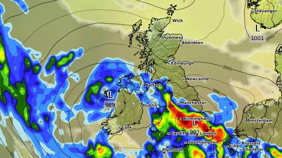
GFS weather model maps indicate that major cities including Birmingham, Manchester, and London could face intense downpours next Tuesday. Wales and Northern Ireland are also likely to see heavy rain at times, while Scotland appears to be spared the worst of the deluge.
The Met Office’s long-range forecast for August 23 to September 1 states: “High pressure is likely to be the dominant feature at first, bringing widely fine and dry weather… Whilst this is happening a deep area of low pressure is likely to develop in the North Atlantic. This is linked to Hurricane Erin, which is expected to start to bring a change in weather to the UK, though the timing of this is uncertain.”
Before the weekend, the UK will see a mix of sunny spells and showers. Inland and western areas could reach 25°C on Tuesday, while eastern coastal regions remain cloudy. Wednesday is expected to bring dry weather with sunny spells for most, though there is a low risk of heavy and thundery showers in the far south and south-west.




