
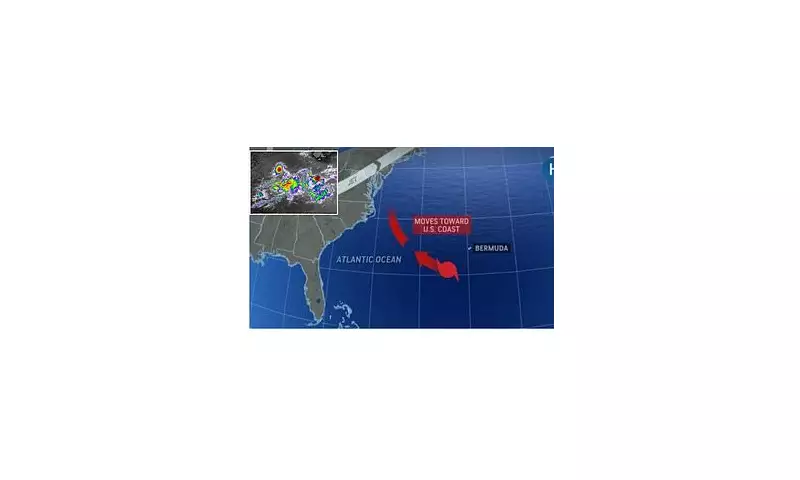
Storm Erin is barrelling towards the United States, sparking urgent warnings from meteorologists who say this could be a sign of increasingly severe Atlantic hurricanes. The storm's rapid development has experts concerned about the growing intensity of tropical systems in the region.
Why Storm Erin Matters
What makes Storm Erin particularly noteworthy isn't just its current path, but what it represents in the larger picture of climate change. Scientists observing the storm note several troubling characteristics:
- Unusually warm ocean temperatures providing fuel for rapid intensification
- A broader pattern of stronger tropical systems forming earlier in the season
- Increased moisture in the atmosphere leading to heavier rainfall potential
The Climate Change Connection
Research teams have identified clear links between human-caused climate change and the increasing power of Atlantic hurricanes. Warmer sea surface temperatures act like rocket fuel for tropical storms, while rising sea levels compound the danger from storm surges.

"We're seeing storms reach major hurricane status faster than we did just decades ago," explained Dr. Sarah Wilkins, a leading meteorologist at the National Hurricane Center. "Storm Erin fits this concerning pattern."
What to Expect
Current projections suggest Storm Erin will bring:
- Dangerous surf conditions along the eastern seaboard
- Potential for flash flooding in coastal communities
- Possible disruptions to shipping and air travel
Emergency management officials urge residents in potentially affected areas to review their hurricane preparedness plans and stay updated on the storm's progress.


