Weather maps show the UK will be hotter than Ibiza within days, but the Met Office has warned of thunderstorms and the potential for weather warnings this week.
Temperature rise expected
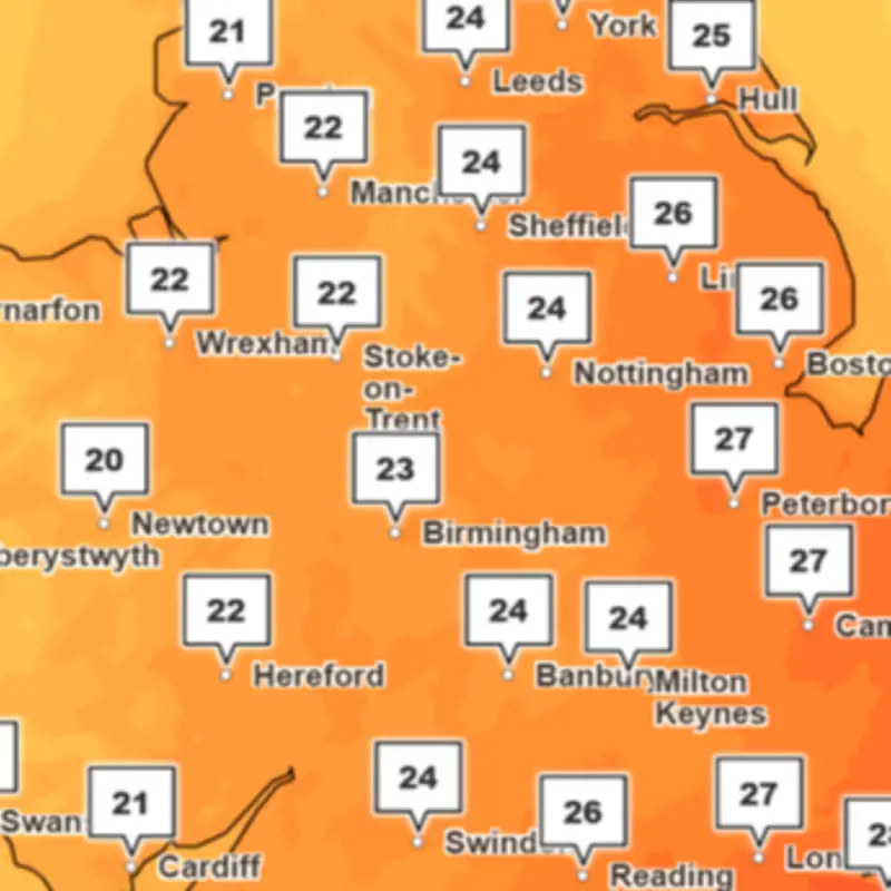
Temperatures across the UK are expected to become hotter than Ibiza this week, with thunderstorms also forecast for Wales. A week of contrasting conditions is expected, with a combination of increasingly warm and humid conditions and possible heavy rain, according to the Met Office.
Temperatures are expected to rise through the week, with parts of England potentially reaching the high twenties by Thursday and possibly approaching 30°C in the southeast on Friday, hotter than the weather forecast for Ibiza.

Rain and thunderstorms
As well as the warmer weather, there will be spells of rain and an increasing chance of thunderstorms towards the end of the week. The forecast from the Met Office states: "Many areas will see a fine and largely dry start to the week, with light winds and hazy sunshine. Northern coastal areas will be cloudier and cooler, with a chance of light rain at first."
"Central, eastern and southeastern areas will remain largely dry with variable cloud and sunny spells, with temperatures possibly reaching around 27°C in isolated spots."
Parts of Wales will continue to see unsettled conditions on Wednesday with outbreaks of rain at times, and the Met Office has warned that there could be potential weather warnings.
Thursday and Friday outlook
Thursday will have a fine and dry start for many areas in east Wales with the best of the sunshine towards the southeast. Rain and cloud will cover most of west Wales, with some heavy rain possible on Thursday.
The Met Office states: "Temperatures on Thursday will remain near normal in the north and west but become warm to very warm and increasingly humid in the southeast, with highs into the upper 20 degrees Celsius possible. There is also a small chance of an isolated thunderstorm later in the day."
Friday will be the warmest day of the week with much of Wales starting largely fine, though there is an increasing risk of thunderstorms developing, particularly in the southeast.
Expert comment
Met Office deputy chief forecaster Tom Crabtree said: "This week’s contrasting weather of both heat, rain, and potential thunderstorms is a result of a low pressure system influencing the UK from the northwest. The southerly flow stalls a front over the west of the UK whilst allowing temperatures to build in the southeast."
"Friday is set to be the warmest day of the week, but it’s important to note that peak temperatures could be impacted by cloud cover. Temperatures are likely to range from 26 to 28°C, with the potential to approach 30°C in parts of southeast England."
"Elsewhere temperatures will remain closer to average but could be warm at times in parts of Wales and the west Midlands. Of course, the picture for the weekend will become clearer closer to the time, so keep an eye on our forecasts as the week goes on."