
Winter has arrived with a vengeance as Arctic blizzards and gales of up to 80mph are set to batter the UK, bringing significant snowfall and hazardous conditions. The Met Office has issued a red-alert warning for Scotland, where winds of at least 75mph are expected, with gusts reaching 90mph during rush hour in several regions.
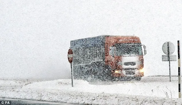
Forecasters warn of disruption across the country, with up to 4 inches of snow possible as far south as Birmingham. Motorists face 'extremely poor' travel conditions and significant delays, particularly between 3pm and 6pm. Police in Scotland have urged drivers to travel only if necessary, with the Forth and Tay road bridges likely to close due to high winds.
Meanwhile, Britain's only polar bear, Walker, celebrated his third birthday at the Highland Wildlife Park in Scotland, enjoying the snow in his enclosure. In Yorkshire, a rare white reindeer named Snowy, born with a genetic condition, has delighted visitors at a farm garden centre.


