
The UK is set for a dramatic shift in weather, trading floodwaters for a deep freeze as the Met Office forecasts a significant cold snap with potential snow in the coming days. This abrupt change comes as communities, particularly in Wales, begin clearing up after widespread flooding caused by Storm Claudia.
From Floods to Freeze: A Nation's Weather Whiplash
The immediate aftermath of Storm Claudia saw severe impacts, with a major incident declared in Monmouthshire, Wales. The River Monnow burst its banks, forcing evacuations in the town of Monmouth. Rainfall totals were exceptionally high, with 119.6mm recorded in 12 hours at Tafalog in Gwent and 80.6mm in Suckley, Worcestershire.
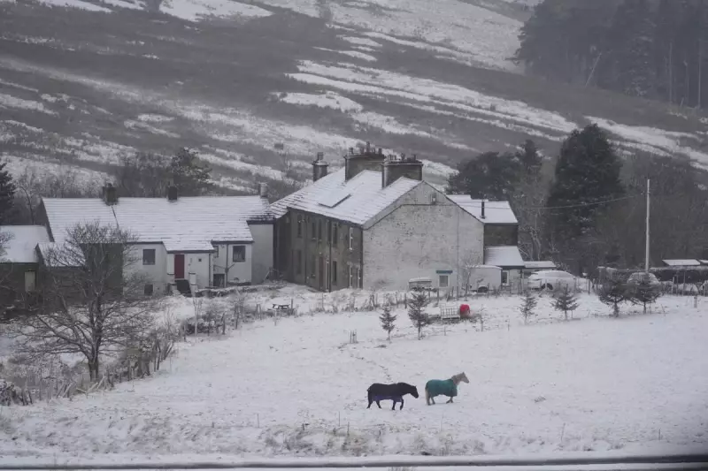
Now, attention turns to a plunge in temperatures. According to Met Office meteorologist Simon Partridge, temperatures are set to drop by eight to 10 degrees, making double figures difficult to reach. He warned of the first widespread frost on Monday morning, with lows potentially sinking to a biting -7C in some areas.

The Cause of the Big Chill
This cold snap is being triggered by a shift in wind patterns. Recent mild spells, driven by southerly winds, are being replaced by a cold northerly flow originating from the Arctic. Met Office deputy chief meteorologist Dan Holley explained that high pressure to the northwest is the driving force behind this change, ushering in much colder conditions than the UK has experienced lately.
When and Where Will Snow Hit?
The cold air will bring with it the potential for wintery precipitation. The Met Office indicates that snow is most likely on Tuesday and Wednesday. A band of rain, sleet, and hill snow is expected, primarily affecting northern parts of the UK.
Wintery showers, a mix of rain, sleet, and snow, could target several regions, including:
- Scotland
- Northern Ireland
- The North Yorkshire Moors
- West Wales
- The moors of southwest England
While Thursday is forecast to be dry and sunny for most, it will be accompanied by sharp overnight frosts.
Official Warnings Issued
In response to the forecast, the UK Health Security Agency (UKHSA) has issued a cold weather alert. This warning is active from 8am on Monday until 8am next Friday and covers the East Midlands, West Midlands, North East, North West, and Yorkshire and the Humber. These alerts are issued when cold weather is expected to have a significant impact on public health.
Adding to the concerns, Dan Holley from the Met Office cautioned that it is possible warnings may be issued for snow and ice as the week progresses, urging the public to stay updated on the latest forecasts.


