The Met Office has forecast a massive 500-mile band of rain set to sweep across Scotland, Northern Ireland, Northern England, and North Wales on Thursday.
Rain Band Details
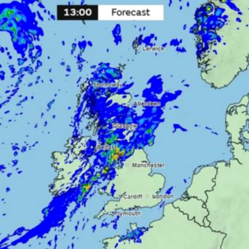
Weather maps show a band of rain stretching over 500 miles from Northern Scotland to North Wales at 1pm on Thursday. While some regions will enjoy heatwave-level temperatures reaching 30C, other areas face considerably wetter conditions.
Southern England may experience thunderstorms on Thursday evening, following a day of hot and muggy conditions.

Forecaster's Explanation
On the Met Office YouTube channel, forecaster Alex Burkill explained: "It's worth highlighting that there's the potential for some thunderstorms to kick off across parts of the southeast later on Thursday through the evening in particular because of that hot, humid air coming in from the south, but that's only a low risk at the moment."
He continued: "Now, there is a fair amount of rain to come through this week, and most of it is coming in from the west southwest, but actually day by day, where we see the heaviest rain that actually changes."
"So, there will be some heavy, persistent rain feeding eastwards across southern parts of England through Wednesday. And then that front on Thursday pushes northwards bringing rain across Northern Ireland, parts of Western Northern Wales, Northern England, and Scotland."
Despite the heavy downpours, overall precipitation levels are likely to stay relatively modest. Burkill added: "It is going to be a bit soggy at times, but rainfall totals through the whole week don't look especially high. Some places could get in excess of 50 millimeters perhaps, but that's not a huge amount of rain. In fact, some people will be quite glad to get some rain at this time of year."
Timeline of Rain
Meteorological charts indicate the rain band blanketing Ireland and Northern Ireland alongside portions of West Scotland from 6am on Thursday. By 10am, nearly all of Scotland and Northern Ireland will be under the rain band, which will extend across North West England, with notably intense concentrations over Cumbria.
This pattern is expected to persist throughout much of the day, with the rain band moving eastwards and reaching the North East by 1pm. At that point, the rain band will stretch more than 500 miles from North Wales through to Northern Scotland. By 4pm, Northern Ireland should have cleared, with the most intense downpours predicted over Cumbria, the Pennines, and sections of the North East.
Affected Areas
Full list of areas set to see persistent heavy rain showers on Thursday:
- Northern Ireland
- North Wales
- Northern West England
- North East England
- Scotland
- Northern Scotland
- Eastern Scotland
- Western Scotland
Potential for thunderstorms on Thursday evening:

- South East England