Newly released satellite images show the devastating impact of nearly three weeks of Israeli airstrikes on cities and towns across Gaza. The images, provided by Maxar Technologies and Planet Labs, reveal entire neighbourhoods reduced to rubble, with apartment buildings crumpled and lying in ruins.
The bombardment is part of Israel's retaliation for the 7 October attacks by Hamas, which killed 1,400 people and took over 200 hostages. Israel has vowed to wipe out Hamas, which rules Gaza, and has imposed a siege while preparing a ground invasion. The Hamas-run health ministry reports that more than 7,000 people, many of them civilians, have been killed in the strikes.
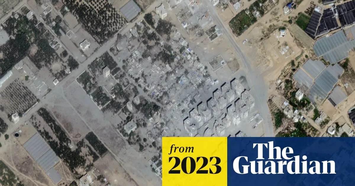
In Beit Hanoun, near the northern border with Israel, four- and five-storey buildings are in various states of collapse, with some missing huge chunks and others broken in half. The Israeli air force announced that the area, a hub for Hamas, had been struck 120 times. Images show entire neighbourhoods turned into grey wastelands.

The UN has cited an estimate from the Gaza Ministry of Housing that 42% of all housing units in Gaza have been damaged or rendered uninhabitable. The destruction has displaced between 400,000 and one million Palestinians, according to the UN and Palestinian Red Crescent. In the Al-Atatra area of Beit Lahiya, satellite images show ash and rubble spreading through entire neighbourhoods.
The UN warns that its fuel supplies are dangerously close to running out, threatening its ability to operate in Gaza. In Al-Zahra, south of Gaza City, Israeli missiles flattened more than 20 buildings. One resident, Rami Abu Wazna, told AFP: 'Even in my worst nightmares, I never thought this could be possible.'