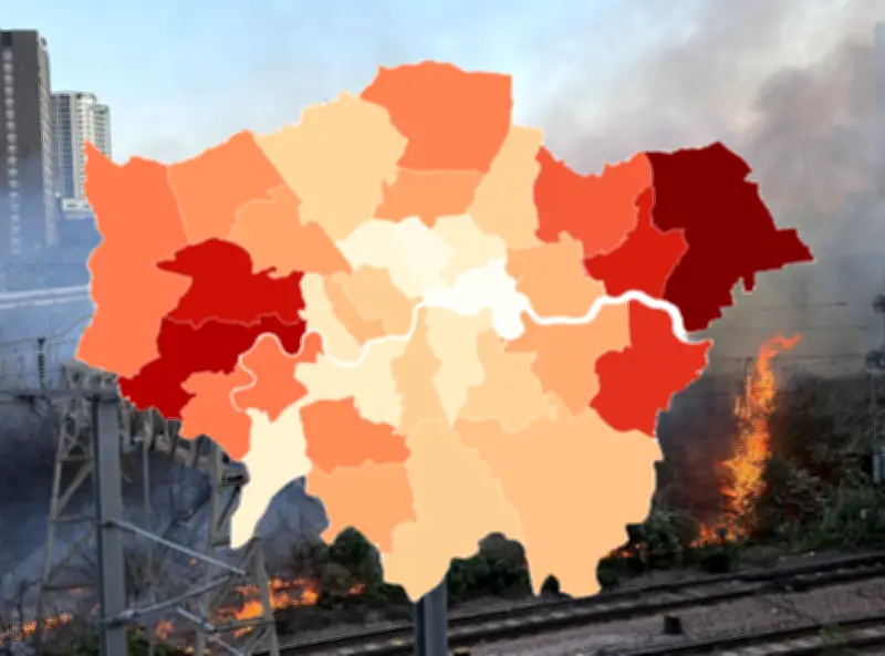
London is at "extreme" risk of wildfires as it endures its third heatwave of the year, civic chiefs warn. Mayor Sadiq Khan took the unprecedented step of urging Londoners to create firebreaks to protect their homes after a blaze swept through 30 gardens and damaged properties in Walthamstow on Sunday.
Boroughs at Highest Risk
Experts at geospatial analytics company Map Impact analysed the risks in every borough. The wildfire danger is greatest in Havering, in the far east of the capital, where just over 11% of its land is assessed to be at high or very high risk. Hounslow, in the west, follows at just under 10%. If a major blaze spread there, it could impact Heathrow airport in neighbouring Hillingdon. Ealing ranks third, with just over 9% of the borough at high or very high risk.
Outer London boroughs with more green spaces face higher risks. Barking & Dagenham (8.69%), Bexley (8.21%), Redbridge (7.14%), Richmond-upon-Thames (6.28%), Hillingdon (6.23%), Enfield (6%), Merton (5.81%), Harrow (5.54%), Haringey (5.08%), and Brent (5.04%) follow.
Inner London and Parks
Some Inner London boroughs have higher risk than expected due to Royal Parks. Westminster (3.54%) includes parks around Buckingham Palace that can become tinderboxes in arid conditions. Sutton and Greenwich both stand at 4.84%, followed by Newham (4.52%), Kensington & Chelsea (4.25%), Bromley (4.07%), and Lambeth (3.56%).
Waltham Forest, which includes Walthamstow, has about a third of the risk of Havering and Hounslow (3.48%), followed by Lewisham (3.36%) and Barnet (3.14%). Boroughs with less than 2% of land at high or very high risk include Hammersmith & Fulham (1.98%), Southwark (1.97%), Wandsworth (1.77%), Hackney (1.72%), Kingston-upon-Thames (1.4%), and Camden (1.15%). The lowest risk areas are Islington (0.86%), City of London (0.2%), and Tower Hamlets (0.17%).
Causes and Climate Context
Wildfires can be caused by sunlight on glass, a dropped cigarette butt, a BBQ, or sparks from machinery. Richard Flemmings, chief executive of Map Impact, told The Standard: "The combination of hot temperatures, very dry vegetation and strengthening winds creates the conditions in which small fires can spread rapidly and become much harder to control. Our WildfireView data shows that the highest susceptibility remains concentrated around London's outer boroughs and urban fringe, where large areas of grassland, scrub and open space sit alongside homes and infrastructure."
He added: "Climate change is increasing the frequency of the hot, dry weather patterns that elevate wildfire risk across the UK. Conditions that were once considered exceptional are becoming more common, extending the wildfire season and increasing the exposure of communities, businesses and public services."
Guidance and Precautions
London has been hit by record temperatures in three heatwaves so far this year, with the first two in May and June estimated to have killed 1,000 people in the capital and wider South East. The number of 30°C days in the city has quadrupled in the ten years to 2025 compared to previous decades.
The London Fire Brigade (LFB) advises clearing two to three metre strips around gardens to create firebreaks. LFB Assistant Commissioner Tom Goodall said: "As these very warm and dry conditions continue, we encourage all landowners, including households, to take any precautionary measures they can to protect properties in the event of a fire. Residents can also help minimise damage by keeping grass cut low and cutting back trees and shrubbery, particularly around the edges."