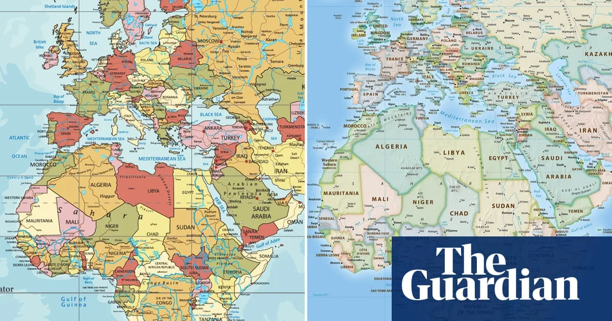
The African Union has endorsed a campaign to end the use of the 16th-century Mercator map by governments and international organisations, in favour of a projection that more accurately reflects Africa's size.
The Mercator map, created for navigation, exaggerates the size of landmasses near the poles and diminishes those near the equator, making Africa appear smaller than it is. Selma Malika Haddadi, deputy chair of the African Union Commission, said the map fostered a false impression that Africa was 'marginal' despite being the world's second-largest continent.
The Correct the Map campaign, led by advocacy groups Africa No Filter and Speak Up Africa, has urged adoption of the 2018 Equal Earth projection. Moky Makura, executive director of Africa No Filter, described the Mercator as 'the world's longest misinformation and disinformation campaign'.

Fara Ndiaye, co-founder of Speak Up Africa, said the map affected African children's identity and pride, adding that the group was working to make Equal Earth the standard in classrooms across the continent. The African Union said the campaign aligned with its goal of 'reclaiming Africa's rightful place on the global stage'.
The Mercator projection remains widely used, including by schools and technology companies. Google Maps switched to a 3D globe on desktop in 2018, but the Mercator remains the default on mobile. The World Bank said it already uses the Winkel tripel or Equal Earth projections for static maps and is phasing out Mercator on web maps. A request has been sent to the UN geospatial body for review.
Other regions have also backed the effort. Dorbrene O'Marde, vice-chair of the Caribbean Community (Caricom) Reparations Commission, endorsed Equal Earth as a rejection of the Mercator map's 'ideology of power and dominance'.