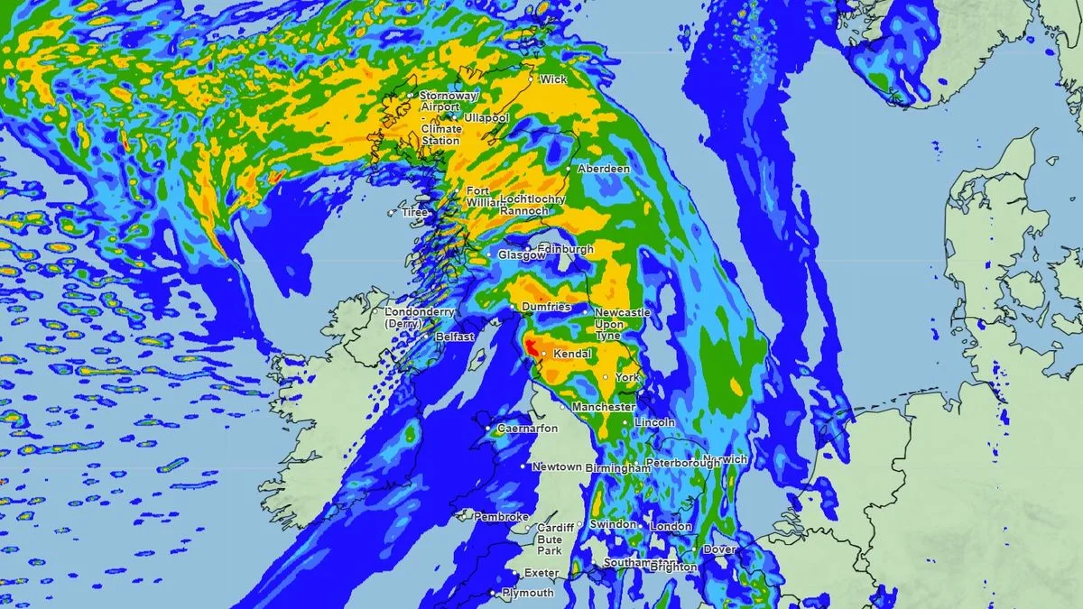
The Met Office has issued urgent severe weather warnings as Storm Amy batters the United Kingdom with potentially destructive 70mph winds and torrential rainfall. The storm's arrival has prompted concerns about widespread disruption to transport networks and potential damage to properties across affected regions.
Immediate Threats and Affected Areas
Meteorologists have raised amber weather warnings for wind across southwest England and Wales, indicating a significant threat to public safety. The storm system is expected to generate wind gusts reaching 70mph in coastal areas, with inland regions facing speeds up to 60mph. These conditions pose genuine risks of flying debris, structural damage, and dangerous travel conditions.
Heavy rainfall accompanying the storm has triggered additional flood alerts, particularly concerning for areas already saturated from recent precipitation. The Environment Agency has deployed teams to monitor river levels and coastal defences as the system moves across the country.
Travel Chaos and Public Safety
Transport networks are preparing for significant disruption as Storm Amy intensifies. Network Rail has announced speed restrictions on several routes, while major bridge crossings including the Severn Crossing and M48 bridge face potential closures if wind speeds exceed safety thresholds.
Aviation authorities have warned passengers to expect flight delays and cancellations, particularly at airports in the storm's path. Road users are being advised to reconsider non-essential journeys, with high-sided vehicles and motorcyclists facing particularly hazardous conditions.
Emergency Response Readiness
Emergency services across the UK have been placed on heightened alert, with additional resources allocated to respond to storm-related incidents. Power companies have contingency plans in place, though they acknowledge that widespread outages are likely given the forecast wind speeds.
Local authorities in the most vulnerable areas have established emergency rest centres should residents need to evacuate flood-threatened properties. The public is being urged to secure loose outdoor items and avoid coastal paths and promenades where large waves present additional dangers.
Longer-Term Weather Outlook
While Storm Amy represents the most immediate weather threat, meteorologists are monitoring further unsettled conditions developing in the Atlantic. The current storm system is expected to clear eastwards by tomorrow afternoon, but residual impacts including localised flooding may persist for several days.
The Met Office continues to update its warnings as the storm progresses, with the public advised to monitor official channels for the latest safety information and travel advice.