
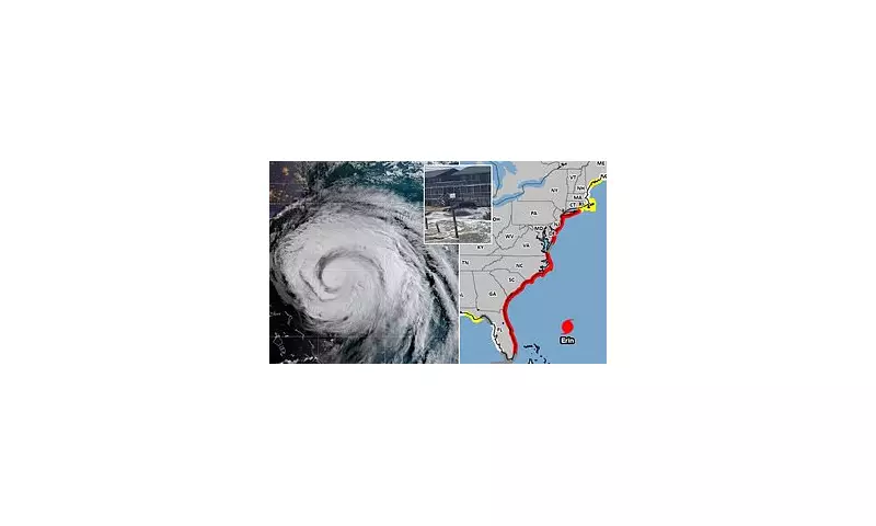
Fresh meteorological data has unveiled a significant and alarming shift in the projected path of Hurricane Erin, sending weather forecasters and emergency services across the UK into a state of heightened alert. The storm, which has been churning across the Atlantic, is now predicted to take a more northerly and erratic track, increasing the potential for a direct impact on British shores.
The latest sophisticated modelling from the Met Office indicates that the storm system could bring a potent cocktail of severe weather conditions. The primary concerns are torrential, relentless rainfall threatening significant flash flooding and powerful, damaging winds capable of causing travel chaos and power disruptions.
An Unpredictable and Evolving Threat
Meteorologists are emphasising the highly unpredictable nature of this weather event. Small fluctuations in atmospheric pressure and jet stream patterns are causing the forecast models to change frequently. "The situation remains fluid," stated a senior forecaster. "While we are growing more confident in the broader trend, the exact severity and precise locations of the worst impacts will likely shift until the last moment. This is not a storm to be complacent about."

Potential Impacts on the UK
If the storm maintains its current strength and trajectory, the nation could face:
- Coastal Onslaught: High waves and storm surges battering western and southern coastlines, leading to erosion and potential damage to sea defences.
- Inland Deluge: Widespread heavy rain, with the risk of over 100mm falling in a short period, triggering flooding for rivers and surface water in vulnerable areas.
- Transport Turmoil: Major disruptions are anticipated across road, rail, and air networks, with ferry services likely to be suspended.
- Power Precautions: Energy companies are preparing for the possibility of widespread power cuts caused by falling trees and branches damaging overhead lines.
Officials are urging the public, especially those in projected affected regions, to take the warnings seriously. Now is the time to secure loose garden items, prepare an emergency kit with torches and batteries, and stay updated via the official Met Office website and app. Checking on vulnerable neighbours is also strongly advised as the storm approaches.


