
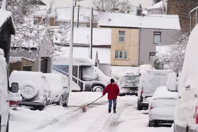
The UK has woken up to a notable early taste of winter, with parts of the country blanketed by up to 7cm (2.7 inches) of snow overnight and into Wednesday morning. The cold snap has brought the first significant snowfall of the season, transforming landscapes from London to the Scottish Highlands.
Where the Snow Has Fallen
Significant accumulations were recorded by Met Office weather stations across the nation. Lake Vyrnwy in Powys, Wales, saw 7cm of lying snow by 8am, matching the depth recorded in Altnaharra in the Scottish Highlands. Other areas reporting substantial snow cover included Lerwick in Shetland (5cm), Loch Glascarnoch (4cm), and Aviemore (2cm).
Further south, a Met Office spokesman confirmed that while there were no official records of lying snow, many areas experienced falling snow. Residents in London, Hertfordshire, Berkshire, Surrey, Essex, Shropshire, and Northumberland all reported sightings, with some areas away from official stations receiving a light 'dusting'.

Ongoing Forecast and Warnings
The chilly conditions are set to continue, driven by a plunge of cold Arctic air. The Met Office has stated that wintry showers will persist on windward coasts throughout the day, particularly affecting north Scotland and the east and west coasts of the UK.
In contrast, central inland areas can expect brighter and drier conditions. However, multiple weather warnings remain in force. An amber warning for snow has been issued for part of north-east England, with several yellow warnings for ice and snow covering Northern Ireland, parts of Wales, northern and south-westerly England, and much of Scotland.
Expert Insight on the Cold Snap
Met Office Chief Forecaster Neil Armstrong attributed the conditions to 'cold Arctic air from the north', which is firmly in charge of the UK's weather. He highlighted that the coldest conditions are expected on Wednesday and Thursday.
Mr Armstrong warned: 'Winter hazards are likely through the next few days, with snow and ice a particular hazard.' He added that while not all areas will see lying snow, frequent showers could lead to accumulations of 2-5cm in exposed regions. On higher ground in Scotland, 15-20cm is possible, with the potential for 15-25cm over the North York Moors and Yorkshire Wolds.


