Commuters across northern England are facing another day of travel chaos after severe blizzards swept across the North York Moors, leaving numerous motorists stranded in rapidly deepening snow drifts.
Travel Chaos Grips Northern Roads
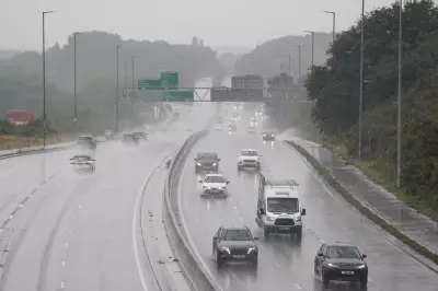
Yesterday's white-out conditions trapped drivers on snow-choked roads as an Arctic blast pushed temperatures well below freezing across much of Britain. The situation became particularly critical on the A171 near Whitby, where multiple crashes triggered severe tailbacks during the afternoon.
Footage from the scene showed lines of vehicles crawling through near-blinding conditions before police made the decision to close the route entirely. By midnight, the stretch remained completely impassable to all traffic, with images posted online capturing cars and a lorry battling the treacherous conditions.

Amber Warning Issued as Deep Freeze Continues
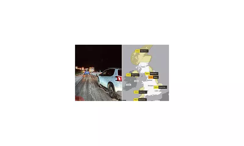
The ordeal for residents and travellers may be far from over, with the region coming under an amber weather warning for snow from 3am to 9pm today. The Met Office has warned that up to 25cm of snow could accumulate on higher ground across the North York Moors.
Meanwhile, five separate yellow warnings for snow and ice blanket swathes of the UK, including the north-east coast, Cornwall, Devon and western Wales. The bitter cold air continues to grip the country, with overnight lows of -6C expected in northern rural areas, while the Met Office is warning temperatures could plunge to a bone-chilling -12C in parts of Scotland on Friday.
Rural Communities Risk Becoming Cut Off
Met Office meteorologist Greg Dewhurst confirmed that sleet and snow showers would continue to lash coastal areas, while the national forecaster warned that rural communities within the amber zone risk becoming cut off entirely as gusty winds whip up 'occasional blizzard conditions'.
Speaking about the ongoing situation, Mr Dewhurst said: 'Thursday will be a sunny day for most, but there will be further sleet and snow showers for coastal stretches which will filter a little inland too. Heavy across north-east England in particular.'
The highest snowfall totals from Wednesday night through Thursday are expected across the Sperrins, North Yorkshire Moors, Northwest Highlands, Grampians and upland Pembrokeshire.
Travel Advice and Emergency Measures
National Rail has urged passengers to check services before travelling amid speed restrictions, potential cancellations and delays. Road users are also being advised to exercise extreme caution.
Shaun Jones, an AA Expert Patrol, emphasised the dangers: 'When snow and ice hit, the roads can quickly become treacherous. Stopping distances can increase tenfold on icy surfaces, so slowing down and leaving plenty of space is absolutely vital.'
He added: 'Drivers should plan ahead, stick to main routes and allow extra time for their journey.'
Meanwhile, in London, Mayor Sir Sadiq Khan has activated the capital's Severe Weather Emergency Protocol (SWEP), which provides extra accommodation for homeless people during conditions that could pose a threat to life. The protocol is activated when temperatures fall to 0C (32F) and was in place for 22 nights last winter when London boroughs housed more than 2,000 people.
While temperatures are expected to begin rising closer to seasonal averages at the weekend with the arrival of wetter and windier weather, forecasters confirm it will not be as 'exceptionally mild' as experienced earlier in November.