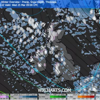
A severe Arctic freeze is set to grip the United Kingdom this week, heralding the first major cold snap of the season. A formidable 326-mile wall of snow is forecast to sweep across the nation, sparking a rare and significant weather event that has prompted multiple Met Office warnings.
Maps Show Extent of Snow and Freezing Rain
Detailed weather maps from Ventusky reveal the sheer scale of the impending weather system. The band of snow is projected to stretch an incredible 326 miles, from Ullapool in the Scottish Highlands all the way down to Manchester in Northern England. The maps also indicate that areas including Merseyside, Lancashire, Greater Manchester, and the west coast of Scotland could see up to 8mm of freezing rain.
The Met Office has highlighted the particular danger of this freezing rain, describing it as a rare type of liquid precipitation that turns to ice instantly upon contact with cold surfaces. This phenomenon creates extremely hazardous conditions on roads and pavements.
Widespread Warnings and Disruption Forecast
The UK's national weather service has issued a series of yellow weather warnings for snow and ice across vast swathes of the country. A warning for Scotland remains in effect until 6pm today, with forecasters predicting accumulations of 2-5cm above 150 metres and potentially 5-10cm above 400 metres in the Highlands.
Residents in affected areas have been advised to expect significant delays and travel disruption. A separate yellow snow and ice warning for northern Scotland and the Isles is active from 6pm today until 9pm on November 20. Furthermore, a yellow ice warning for northern England and southern and central Scotland was in place until 12pm today.
Prolonged Cold Spell with Sub-Zero Temperatures
Deputy Chief Forecaster Tom Crabtree provided a stark outlook for the coming days. Wednesday to Friday will be the coldest part of the week, he stated, noting this period has the greatest potential for impactful weather. He warned that overnight temperatures could plummet to a biting -10°C, with a significant wind chill from strong northerly winds making it feel even colder.
Wintry snow showers are expected to extend south through Wednesday and into Thursday, mainly affecting north-facing coastal areas. Accumulations of 2-5cm are possible in some low-lying areas in the north and east, while hills in parts of Northern Ireland, the northeast of England, and Scotland could see 5-10cm of snow. Above 300 metres in parts of northeastern England and Scotland, accumulations of a staggering 15-20cm are possible.
With this being the first severe cold snap of the year, the public is urged to keep up to date with the latest forecasts as warnings may be updated.


